List of county roads in Hennepin County, Minnesota
It then continues as Old Shakopee Road (and a short bit of 98th Street) for the rest of its route through the south side of Bloomington.
Just west of Bde Maka Ska, it turns southwest and follows Excelsior Boulevard.
(The north branch of this Y-shaped intersection is a continuation of Lake Street and is County Road 25.)
Lake Street was originally used as a path for soldiers traveling from Fort Snelling to Bde Maka Ska.
Segments of Excelsior Boulevard and Lake Street remained under state maintenance until 1988.
The western section is Minnetonka Boulevard from County Road 101 in western Minnetonka to the junction with County Road 25 and France Avenue South at the border between St. Louis Park and Minneapolis.
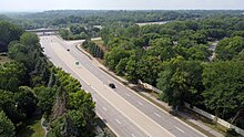
The West River Road segment of County Road 12 was previously old U.S. 169 until the late 1970s, then part of State Highway 252 (MN 252) until State Highway 610 (MN 610) was completed in 1999 between the Richard P. Braun Bridge and Osseo.
The western section begins at the west junction of U.S. Highway 12 in Wayzata and heads westward through Minnetonka Beach, Spring Park, Mound, and Minnetrista before crossing the Carver County line and continuing as Carver County Road 24.
The eastern section is Gleason Lake Road from the east junction of U.S. 12 in Wayzata to Vicksburg Lane at the Plymouth / Minnetonka border.
There was a second disjoint section of County 17 that ran along France Avenue between Minnetonka Boulevard and Cedar Lake Road in Minneapolis.
County Road 19 begins at State Highway 7 (MN 7) in Excelsior and dissects Lake Minnetonka through Tonka Bay and Orono, then continues northward through Independence, Maple Plain, Medina, Loretto, Corcoran, and Hanover, before crossing into Wright County at the Crow River and continuing northward as Wright County Road 19 through St. Michael and Albertville.
The segment from Franklin Avenue to Lake Street was previously the routing of old U.S. Highway 169 until the late 1970s.
County Road 25 is the decommissioned segment of old State Highway 7 (MN 7) between State Highway 100 (MN 100) in St. Louis Park and the intersection of Lake Street and Excelsior Boulevard near Bde Maka Ska in Minneapolis.
This is a stub that allows travelers from Baker Park Reserve via County 19 more direct access to U.S. 12 by bypassing residential areas of Maple Plain.
A previous segment of County 32 extended north of Highway 62 to West 50th Street in Minneapolis.
A previous segment of County 34 extended beyond Old Shakopee Road to the Dan Patch Line Bridge, a combined highway / railroad bridge across the Minnesota River that was closed to vehicular traffic in the late 1970s.
The segment of County 35 from Washington Avenue to West 46th Street is one-way southbound.
Northbound traffic in this segment is diverted to Park Avenue South (County 33).
in Minneapolis from Interstate 35W to the Saint Paul city limits boundary line.
County Road 40 is Glenwood Avenue from State Highway 55 (MN 55) in Golden Valley to 8th Street near the Target Center in downtown Minneapolis.
County 3 between E. Bde Maka Ska Parkway and Dupont Avenue South is one-way eastbound.
The second section runs between Minnehaha Avenue and the Ford Bridge over the Mississippi River towards Saint Paul, where it turns into Ramsey County Road 42.
Portions of County Road 81 are known in the present day as West Broadway and Bottineau Boulevard.
County Road 109 is 85th Avenue North from State Highway 252 (MN 252) in Brooklyn Park to Zachary Lane in Maple Grove, then Weaver Lake Road from Zachary Lane to Interstate 94 in Maple Grove.
County 109 between Interstate 94 and Zachary Lane was realigned from a road with many sharp curves in a gravel pit area to its current, straighter route in the early 1990s.
It is going to be extended east as Dayton Parkway to County 81 by the end of 2021 with an interchange added at Interstate 94.
County Road 122 is former State Highway 122 across the Mississippi River on the Washington Avenue Bridge in Minneapolis, and is partly built to freeway standards.
This original route was significantly altered due to the construction of Interstate 94 in the 1960s and the development of Maple Grove in the 1980s-90s, resulting in a period of two disjoint sections of County 130 between the mid-1970s and 2005.
The stretch of County 153 between West Broadway and Lyndale Avenue North was previously part of old State Highway 278 until 1982.
A previous extension of County 156 extended south of Highway 55 to Wayzata Boulevard (then U.S. 12), decommissioned upon the 1993 completion of Interstate 394.