dBZ (meteorology)
It is mostly used in weather radar, to compare the equivalent reflectivity factor (Z) of a remote object (in mm6 per m3) to the return of a droplet of rain with a diameter of 1 mm (1 mm6 per m3).
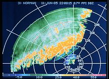
In short, the higher the dBZ value, the more likely it is for severe weather to occur in the form of precipitation.
[3] The radar reflectivity factor (Z) of precipitation is dependent on the number (N0) and size (D) of reflectors (hydrometeors), which includes rain, snow, graupel, and hail.
By dividing Z with the equivalent return of a 1 mm drop in a volume of a meter cube (Z0) and using the logarithm of the result (because the values vary greatly from drizzle to hail), one obtains the logarithmic reflectivity LZ, in dBZ: dBZ values can be converted to rainfall rates (R) in millimetres per hour using the Marshall-Palmer formula:[4] The definition of Z above shows that a large number of small hydrometeors will reflect as one large hydrometeor.
In combination with other information gathered by the radar during the same scan (dual polarization products and phase shifting due to the Doppler effect), meteorologists can distinguish between hail, rain, snow, biologicals (birds, insects), and other atmospheric phenomena.