Darfield, New Zealand
It is a gateway to the scenic Waimakariri and Rakaia rivers and the Southern Alps, and is also a popular lift-off place for hot air ballooning.
Darfield is located around the former junction of the railway lines coming from Christchurch and going to Whitecliffs (where coal was mined) and Springfield and on to the West Coast.
This name was changed again to avoid confusion with Hornby [railway] Junction (close by in Christchurch).
A magnitude 7.1 earthquake occurred near Darfield at 4:35 am on 4 September 2010, causing widespread damage to both the town and to surrounding areas including the city of Christchurch.
This includes the world's largest dryer which is used in the process to make instant wholemilk powder.
[6][7] Located on the Canterbury Plains at an altitude of 193 m (633 ft) above sea level, the Köppen-Geiger climate classification for Darfield is Cfb (Oceanic).
On several days a year, Darfield is subject to the nor'west Foehn wind, which is very dry and has the capability to raise the temperature by several degrees per hour.
On the contrary, the town is also susceptible to cold blasts from the Southern Ocean, especially during winter, when a southerly wind blows.
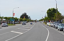
Darfield is described by Statistics New Zealand as a small urban area, and covers 17.58 km2 (6.79 sq mi).
[17] Many industries are present in Darfield, including brick-making, seed cleaning, and a Fonterra factory, which processes milk powder.
Football and rugby fields, tennis courts and a Scouts building are also located in the domain.
Westview Park is located in between the Midland railway line and State Highway 73 and to the west of Four Square Darfield.
It contains a mix of Douglas Fir, Pinus Radiata, Macrocarpa, Larch, Spruce and other exotic species.
The TranzAlpine train stops twice daily (request only); en route to the West Coast and on its return trip back to Christchurch.