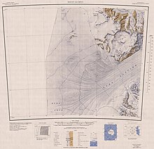
Darwin Glacier (Antarctica)
There are small scale fluctuations due to daily tidal cycles downstream from its grounding line.
This would cause the ice streams flowing into the Ross Sea to be buttressed and thickened, and there is some evidence to support this.
However, there is contradictory evidence from the upper Hatherton Glacier that suggests the ice extent there was lower in the LGM than it is today.
[3] Darwin and Hatherton glaciers both thinned steadily by about 500 metres (1,600 ft) during the last deglaciation between 9,000 and 3,000 years ago.
An almost impenetrable icefall near Tentacle Ridge, 45 metres (148 ft) high and 15 nautical miles (28 km; 17 mi) long, extending in an arc for almost the whole width across the Darwin Glacier.
Named by the Darwin Glacier Party of the Commonwealth Trans-Antarctic Expedition (CTAE) (1956–58) for its similarity to the circle of an opera house.
Mapped by the Darwin Glacier Party of the CTAE, 1956–58, who named it because of the green color of its surface.
A tributary of Darwin Glacier, flowing south between Roadend Nunatak and the Brown Hills.
Named by the members of a New Zealand Antarctic Research Program (NZARP) field group who had a dramatic overturn with their toboggan while driving down the glacier.
Named for John D. McCraw, Dean of Science, University of Waikato, Hamilton, N.Z., a member on a 1959-60 field party to the McMurdo Dry Valleys.
Hinton wintered at McMurdo Station, 1963, and headed a team charged with the maintenance of mechanical equipment at the outlying U.S.
Named by US-ACAN for Robert A. Ragotzkie, project director for United States Antarctic Program (USARP) studies of lakes in the ice-free valleys.
An icefall 2.5 nautical miles (4.6 km; 2.9 mi) wide in the east-central part of Ragotzkie Glacier.
The icefall is a significant distributary of Ragotzkie ice to Alley Glacier, which occupies the valley to the east.
Description: A prominent glacier-filled cirque at the west side of the terminus of McCleary Glacier in Cook Mountains.
A conspicuous nunatak 4 nautical miles (7.4 km; 4.6 mi) west-northwest of Bastion Hill along the north side of Darwin Glacier.
So named by the Darwin Glacier Party (1957) of the CTAE because snow passages resembling turnstiles occur throughout its length.
A comparatively narrow constriction through which the lower Darwin Glacier flows, causing the ice to bank up somewhat in the vicinity of Diamond Hill.
A series of about eight spectacular icefalls, in an east-west line, falling steeply from Bucknell Ridge into the narrowest portion of Darwin Glacier near its mouth.
A coastal point with some rocky exposures at the south side of the mouth of Darwin Glacier, where the latter flows into Ross Ice Shelf.
Named by US-ACAN for James H. (Scot) MacDonald, journalist who as a member of U.S. Navy Squadron VX-6 worked several seasons at McMurdo Station between 1958 and 1961.