Daulat Beg Oldi
It is said to be named after Sultan Said Khan ("Daulat Beg" [The Statesman]) of the Yarkent Khanate, who died here on his return journey from an invasion of Ladakh and Kashmir.
[3][4] Daulat Beg Oldi (DBO) lies at the northeastern corner of the Karakoram Range, at the northern edge of Depsang Plains at an elevation of 5,100 metres (16,700 ft).
Daulat Beg Oldi literally means "spot where the great and rich man died"[7] in Turki.
In Baltistan, the Sultan encountered a population of friendly Muslims, but he turned on them, killing and enslaving them, possibly because they were Shiites which orthodox Yarkandi Sunnis considered heretic.
In the spring, the two parties met up again in Maryul, and the Sultan decided to return to Yarkand, but instructed Haider to conquer Tibet for Islam before his departure.
News of the sultan's death led to a bloody struggle for the succession, ending in the ascension of Abdurashid Khan.
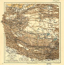
Filippo de Filippi, who explored the area in 1913–1914, described:[18] But on the other hand the caravans come and go incessantly, in the summer, in astonishing numbers.
The first one of the season passed on June 28th, coming from Sanju on the Yarkand road; then more and larger ones came; in July there were four in one day, almost all travelling from Central Asia toward Leh—the Ladakhis usually do their trading at home.
The caravans were of all sizes, from small groups of 3 or 4 men with 5 or 6 animals to large parties with 40 or more pack-animals; the men on foot or riding asses, the better-to-do merchants on caparisoned horses ...Filippi also wrote that the experienced caravaners passed through the Depsang Plains without stopping, travelling a distance of 31 miles between Daulat Beg Oldi and Murgo in a single day.
Indian prime minister Jawaharlal Nehru told the Parliament that the Chinese wished to treat Xinjiang as a "closed area".
[23] The Chinese said little by way of justification for this advancement other than to claim that it was their "traditional customary boundary" which was allegedly formed through a "long historical process".
A border post was established at Daulat Beg Oldi (DBO) in 1960 under the supervision of the Intelligence Bureau (IB).
[1][27] The Indian Army then set up posts at Burtsa, Qizil Langar, at a 'track junction' in the Depsang Plains and at Sultan Chushku.
Routine sorties are carried out using An-32 aircraft to provide relief and supplies to the troops stationed nearby.
It was operated with American-supplied Fairchild Packets from 1962 to 1966, when it had to be closed down suddenly when an earthquake caused loosening of the surface soil, making the area unsuitable for fixed-wing aircraft.
[35][36][37] In 2001, the Indian government decided to construct a motorable road from Leh to Daulat Beg Oldi.
It follows the old winter caravan route via the Shyok River valley going via Murgo, Burtsa Nala and Depsang Plains.