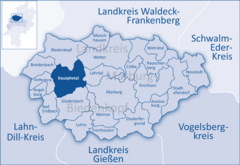
Dautphetal
The highest mountain in this area is the Nimerich (533 m above sea level) northwest of the constituent community of Dautphe.
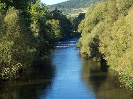
The lowest point anywhere in the area is found on the river Lahn at Elmshausen, where the elevation is 225 m above sea level.
East of the community's municipal lands at Damshausen lies the Rimberg (mountain, 498 m above sea level).
In Charlemagne's time, the area covered by today's community of Dautphetal belonged to the Oberlahngau (a noble domain).
As a result of the Austro-Prussian War in 1866, the Biedenkopf district, formed in 1832 and in which lies what is today Dautphetal, was ceded to Prussia.
Source 1834 - 1967: Historisches Gemeindeverzeichnis für Hessen Heft 1, Die Bevölkerung der Gemeinden 1834 - 1967, Hess.
Landesamt Source after 1998: Statistik der Gemeinde Dautphetal Community representatives were last chosen on 26 March 2006 for a five-year term.
The economy in Dautphetal is evenly split between industry and trade, while the services sector is a bit smaller.
Although Dautphetal with the Lahn valley and its widespread woodlands offers good potential for recreation and tourism, it has hitherto not been exploited as such.
After being founded in 1947 as a simple handicraft business, the firm has steadily grown and is nowadays represented in Europe, North and South America, and even in China.
In the 2001 Middle Hesse Regional Plan, Dautphetal is designated a low centre in the rural area (in terms of Walter Christaller's Central Place Theory).
Furthermore, the greater community is part of the Marburg - Dautphetal - Biedenkopf - (Bad Laasphe) regional development belt.
Moreover, there exists a local transport and population belt, Dautphetal - Gladenbach, with a regional connective function.
This interregionally important road leads from eastern North Rhine-Westphalia (Siegen) through Middle Hesse (Dautphetal, Marburg) and East Hesse (Alsfeld, Bad Hersfeld) to Thuringia (Bad Salzungen) thereby fulfilling the function of interregional transportation axis.
Bundesstraße 453, which is only 15 km long, branches off B 62 in the neighbouring community of Biedenkopf, leading in a southerly direction through the centres of Wolfgruben, Dautphe, Mornshausen and Herzhausen on its way to Gladenbach.
The last two named stations are conveniently placed for the Hesse cross-country bicycle path (Hessischer Radfernweg) R 2.
Owing to its advantageous location in a low mountain range and its attendant great forests and idyllic dales, the whole region is endowed with a substantial trail network.
Its potential, however, was only recognized a few years ago and has been organizationally supported for a short time by the association Lahn-Dill-Bergland e. V. Friedensdorf has since the 1950s been the site of an electrical substation.
Holzhausen and Buchenau each also have a primary school, the latter's having had until 2006 an attached orientation programme (Förderstufe) which was discontinued because the class-size threshold was no longer being met.
In the field of adult education, the district maintains two branches (Dautphetal and Dautphetal-Holzhausen) of the Volkshochschule Marburg-Biedenkopf.
For one, there is the Seniorenzentrum Dautphetal which serves as a nursing home and a residence for the elderly, and for another, there are the Hinterländer Werkstätten, a recognized workshop for the handicapped.
In Dautphetal, the Oberhessische Presse and the Hinterländer Anzeiger are the two daily newspapers, with the latter taking the greater part of the market share.
In the community of Friedensdorf, the "Old Church" (Alte Kirche) has a weaving room, old photographs and a dialectal archive to visit.
The Heimatmuseum Altes Rathaus at the old town hall in Buchenau shows exhibits particularly having to do with household and kitchen, especially from the 1920s to the 1950s.
It came into being as a result of industrialization and its advantageous location between the Lahn, which delivered its energy and the nearby iron ore deposits.
Other buildings: Along with the many events organized by local village fraternities and sororities (Burschenschaften and Mädchenschaften), the Christmas Market in Buchenau has grown to quite a size.
A particular high point is the Grenzgangsfest, held every seven years in Buchenau and relating to an old custom that centuries ago was designed to limit encroachment on the village's woodlands by neighbouring communities.