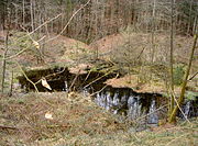
Dinkelberg
The Dinkelberg is a partially forested hill range, up to 536.2 m above sea level (NHN),[1] about 145 km2[2] in area, in the High Rhine region of Germany.
It lies within the counties of Lörrach and Waldshut in the German state of Baden-Württemberg and the Swiss canton of Basel-Stadt.
It lies between the larger settlements of Schopfheim to the north, Wehr to the east, Rheinfelden to the south and Lörrach and the Homburg Forest to the west.
Its highest hill is the Hohe Flum (536.2 m), on which is an open observation tower and an eponymous hotel-restaurant.
Amongst the hills and foothills of the Dinkelberg are the following, sorted by height in metres (m) above sea level, based on the NHN reference system in Germany and the Meter über Meer (m ü. M.) in Switzerland:[1] Amongst the rivers and streams of the Dinkelberg are the Löhrgraben, which flows into the Wiese near Brombach [de], the Bachtelengraben, which empties into the Rhine near Schwörstadt-Unterdorf, the Dürrenbach, which discharges into the Rhine at Rheinfelden and the Hagenbacher Bach and the Waidbach, the headstreams of the Großbach (also called the Warmbach), which also flows into the Rhine, at Rheinfelden-Warmbach.


