Diver navigation
Underwater navigation is usually a core component of most, if not all, advanced recreational diver training.
Use of distance lines is standard in penetration diving, where the divers cannot ascend directly to the surface at all times, and it is possible to lose track of the route out to open water.
[4] Natural navigation, sometimes known as pilotage, involves orienting by naturally observable phenomena, such as sunlight, water movement, bottom composition (for example, sand ripples run parallel to the direction of the wave front, which tends to run parallel to the shore), bottom contour and noise.
Although natural navigation is taught on courses, developing the skills is generally more a matter of experience.
Orienteering, or compass navigation, is a matter of training, practice and familiarity with the use of underwater compasses, combined with various techniques for reckoning distance underwater, including kick cycles (one complete upward and downward sweep of a kick), time, air consumption and occasionally by actual measurement.
[5] Many skilled underwater navigators use techniques from both of these categories in a seamless combination, using the compass to navigate between landmarks over longer distances and in poor visibility, while making use of the generic oceanographic indicators to help stay on course and as a check that there is no mistake with the bearing, and then recognising landmarks and using them with the remembered topography of a familiar site to confirm position.
These cues will not give any precise information about position, but will allow the diver to keep a mental picture of where he or she is and is going.
The important difference is that waves can be seen to travel in a definite direction, whereas surge is a back and forth motion, allowing a possible 180° error.
[5] A regular and distinct ripple pattern on a sand, mud or gravel bottom is an indication that it has been affected by wave action.
This movement produces a ripple pattern on the bottom which is an indication of the wave direction on the surface.
A diver who is familiar with an area can use the diversity variations and patterns to provide orientation cues.
In some places the seaward side of big rocks may have different species from the shoreward face because of the greater exposure to wave action.
This is usually a reliable and consistent feature and is very useful as a navigational aid as it is not affected by visibility, pressure, or the presence of water.
[5] An important concept is that the compass card should not turn, even though it appears to always “swing” to magnetic north.
Large scale charts and maps will usually include a compass rose showing variation.
The current in a dive computer is too small to affect the compass, even when quite near, but the hull of a ship or overhead power lines may make a difference even several meters away.
The angle is called dip and varies with place, so compasses can be corrected for different zones.
These are permanent or temporary lines laid by divers to mark a route, particularly in caves, wrecks and other areas where the way out from an overhead environment may not be obvious.
[8] In cave (and occasionally wreck) diving, line markers are used for orientation as a visual and tactile reference on a permanent guideline.
Two adjacent arrows facing away from each other, mark a point in the cave where the diver is equidistant from two exits.
Their shape does not provide a tactile indication of direction as this could cause confusion in low visibility.
One important reason to be adequately trained before cave diving is that incorrect marking can confuse and fatally endanger not only oneself, but also other divers.
Both voice communications and line signals may be used to direct the movement of the diver and to provide other information.
Periodically reports are issued suggesting the development of underwater GPS technology, but no system is currently available on market.
It is generally thought that the difficulty of locating satellite by signals from underwater at present is not capable of being overcome by existing technology.
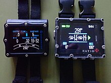
[5] There are also electronic compasses which can provide a digital or analogue display These are based on magnetometer technology.
Both types may have graduations on the card which can be read through a side window to give the bearing directly.
No further effort is needed on the part of the operator, you just find the number the arrow points at and read off the bearing.
[12][13] Some digital cameras for underwater use also have a built in flux-gate compass (such as the Olympus TG series) which can be used for navigation as well as for recording the direction of a photograph.
Recreational divers may learn underwater navigation in stages as part of general diving skills, as in the CMAS system, in the Two-star and Three-star courses, or may learn it as a separate specialty course, as in the PADI system, where the training program and certification are called "Underwater Navigator".


- Top: line arrow – directional information – points along the line leading to the nearest surface with breathable air
- Middle: cookie – non-directional personal marker
- Bottom: hybrid/referencing exit marker – directional personal marker