Double Ditch
It is named for the two visible trenches that once served as fortifications for the village, but archaeologists found a further two ditches outside these indicating that the population was originally larger.
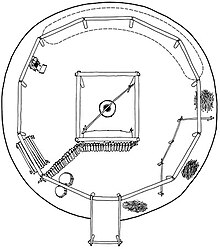
Fortification systems consisted of a deep moat and a wall of wooden posts that formed a palisade.
[5] In 2002 Kenneth Kvamme generated digitally enhanced maps of Double Ditch using radio gradiometry techniques.
Investigators concluded that at the time of its founding, just before 1500, Double Ditch had a peak population of two thousand and an area of 19 acres.
[2] In the mid 18th Century, the innermost (and still visible) fortification ditch was constructed, enclosing an area of four acres, indicating a population at that time of fewer than four hundred.
[2] At that time, the entire surface layer of dirt in the village was laboriously scraped off, possibly after a horrific infection.