Douglas Harbour
Then the sides of the small Douglas River basin were shored up, and there was another try to extend some sort of protective structure out to sea;[5] but this again failed.
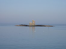
In 1787 the pier was reduced to rubble following a series of winter storms, and so for many years Douglas Harbour was fully exposed to easterly gales, whilst in the bay the perilous Conister Rock claimed many victims.
[7] Work on the Red Pier commenced in 1793 and was completed in 1801, the foundation stone being laid by John Murray, 4th Duke of Atholl, following his appointment as Governor General of the Isle of Man.
[8] The Red Pier was designed by George Steuart,[8] a Scotsman who had long been under the patronage of the Dukes of Atholl, and who carried out a number of important commissions in the Island.
In its[clarification needed] offices passenger arrivals and departures could be logged, and there could be checks for smuggled goods which in the early 19th century were commonplace between the Isle of Man and the United Kingdom.
The construction was the first public works scheme to be carried out on the Isle of Man in many years,[8] and the ceremony was said to have been an occasion for immense civic pride.
Much of this was to do with rival proposals for the construction of breakwaters at Peel and Ramsey both of which, as was the case with Douglas, would ultimately rely on approval and funding from the Admiralty.
[11] The design incorporated landing berths with three platforms at different levels, adapted for loading and unloading at all stages of the considerable tidal range in Douglas with steps for the accommodation of passengers.
[11] This was later amended to construction of the southern breakwater only with the successful tender for the work received from Thomas Jackson of London and a final cost of £47,935 (equivalent to £5,650,000 in 2023)[9] agreed.
Work was also cleared to proceed for the breakwaters at Peel and Ramsey with the contract also carried out by Thomas Jackson and with James Abernethy providing the services of a resident engineer and assuming the role of engineer-in-chief himself.
This was attributed in a report commissioned by the Harbour Commissioners to non-compliance with certain terms of the specification relative to the stone filling and particularly from neglect to form a homogeneous rubble mound to the level of 15 ft (4.6 m) below low water as the true base of the breakwater, hence the failure of the frames which were placed lower than 15 feet.
In a letter to the Commissioners of the Isle of Man Harbours, Abernethy put forward a recalculated structure of a length of 700 ft (213.4 m) and with a revised cost of completion being £33,705 (£2,891,548 in 2014), (£13,116) less than the original contract sum.
The breakwater sustained significant damage in early February 1865, when a storm described as "unequalled in its fury and unexampled in its effects"[14] pounded the structure washing away many of the timber frames which ended up strewn on Douglas shore.
An easterly storm with associated snow on the night of Saturday 5 January 1867, swept away the remaining portion of the breakwater leaving the structure completely demolished.
[16] After Abernethy's breakwater was destroyed, Governor Henry Loch commissioned more plans on behalf of the Isle of Man Government for a larger and more modern structure.
[17] Distinguished civil engineer John Coode was appointed to survey the area of Abernethy's breakwater and to submit his recommendations.
A report was placed before Tynwald on 10 June 1867;[17] it detailed certain differences between Coode's findings in the vicinity of the Pollock Rocks and those of an Admiralty inspection of the same area in 1846.
[17] Coode submitted a detailed and comprehensive plan for the type of structure required, with emphasis on whether it would provide adequate shelter for the harbour and enable the regular and safe landing of passengers and mail, at all states of the tide and weather:[17] steamers had to be able to come alongside during offshore winds.
[17] It was proposed that if the Manx Exchequer paid for the building work, then such vessels could be made to pay a "refuge toll" if they were not trading directly with the island, but just using the port facilities for shelter.
[17] Above this base work were to be laid massive concrete blocks, made with Portland cement[17] and built so as to allow the free escape of water and air during heavy seas.
[17] This principle had been successfully used on several structures in the Mediterranean;[17] it was the only safe, efficient, and reasonably economic form of construction for places such as Douglas, where there is deep water and a considerable tidal range, but no large material[clarification needed] nearby.
[17] It was proposed that building work would take seven years, with the costs detailed as:[17] Coode proposed that the rocks on the shore between the Battery Breakwater and the Fort Anne Jetty, as well as on the south face of Conister Rock, should be excavated down to a flat slope, so as to form "beaching grounds" for vessels including fishing boats.
[17] They further recommended that £140,000 (equivalent to £15,658,100 in 2023)[9] was to be borrowed from the Public Works Loans Commissioners, upon the security of the island's revenue, under the Harbours and Passing Tolls Act, 1861.
At a public meeting at St Johns on Tuesday 26 November 1867, it was moved that further engineering evidence should be sought in order to verify Coode's report.
In a letter to Tynwald, Coode cited his work on a similar structure at Alderney as well as emphasising Hawkshaw's agreement with the costings and calculations, and reaffirming that the materials recommended would be adequate to withstand the frequent winter storms.
Governor Loch worked tirelessly to convince those who still questioned the proposal; he met Rev Christian and put the engineering facts to him in what was described as an affective and conciliatory manner.
Part of the allegations levelled at the breakwater at Port Erin centred around the rubble base of the structure, which Coode had constructed at 15 feet (4.6 m) and which was the same as he intended to carry out at Douglas.
The foreman, named Johnson, who lived locally at Fort William Rd, Douglas, was carrying out his duties on the edge of the large gantry which had been constructed, when he missed his foothold and fell onto the rocks some 30 feet below.
[29] The need for increased passenger facilities had been identified as early as 1904, however such works were continually postponed due to the ongoing costs of various schemes for harbour protection.
[33] A considerable feature of the work was the construction of an openwork viaduct of reinforced concrete 50 ft (15 m) wide, which crossed Circus Beach to the rear of the Isle of Man Steam Packet Company warehouses and the Imperial Hotel and joined the Victoria Pier at its base.