Drewry's Bluff
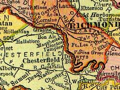
At this sharp bend, Drewry's Bluff on the west side of the James River rose 90 feet (27 m) above the water, commanding a view of several miles' distance downstream and making it a logical site for defensive fortifications.
They were joined in early May by the crew of the Confederate ironclad CSS Virginia which had been scuttled at Craney Island on Hampton Roads to avoid capture as Norfolk fell to Union forces.
While some workers constructed an outer line of entrenchments to protect the land approach to Richmond, others built improvements for the fort, including a chapel, barracks, and quarters for the officers.
Once Fort Darling had been abandoned by the retreating Confederates, the Union forces quickly cleared a path through the obstructions in the James River beneath Drewry's Bluff.
On April 4, 1865, President Abraham Lincoln and his son Tad passed the fort on the way up the James River to visit Richmond.
Soldiers, sailors, and marines from Fort Darling joined the movement westward with Lee's Army of Northern Virginia, ultimately surrendering at Appomattox Court House.