Eagle Ford Group
The Eagle Ford is predominantly composed of organic matter-rich fossiliferous marine shales and marls with interbedded thin limestones.
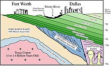
The Eagle Ford outcrop belt trends from the Oklahoma-Texas border southward to San Antonio, westward to the Rio Grande, Big Bend National Park, and the Quitman Mountains of West Texas.
[4] The Eagle Ford was one of the most actively drilled targets for unconventional oil and gas in the United States in 2010,[5] but its output had dropped sharply by 2015.
Fossilized Plesiosaurs, mosasaurs, Fish, shark teeth, crustaceans, sea urchins, feather stars, ammonites, oysters, clams, and other gastropod shells have all been found there.
[2] After the significant drop in sea level (marine regression) associated with deposition of the Woodbine during the Early Cenomanian, the sea level began to rise (marine transgression), allowing for the deposition of Lower Eagle Ford organic-rich marls in South Texas and limestones of the Terrell Member of the Boquillas Formation in West Texas starting at about 96 million years ago.
[14] Although the sandstones and siltstones from this delta, known as the Templeton Member, were originally placed within the Woodbine Formation,[17] the ammonites found within them indicate that they are better associated with the Eagle Ford.
The microfossils found within the marls are predominantly coccoliths and planktonic foraminifera, whereas the limestones contain abundant radiolaria and calcispheres (calcareous cysts produced by some dinoflagellates).
[2] During the Late Cenomanian the Sabine Uplift along the modern-day Texas/Louisiana border became active, causing erosion of Eagle Ford and Woodbine sediments[18] and deposition within the Harris Delta complex.
[14] Towards the end of the Late Cenomanian, the bottom waters of the Texas shelf and the Western Interior Seaway became oxygenated,[20] which may be related to the sea-level maximum associated with the Cenomanian-Turonian boundary event.
It is similar to the older Six Flags and Bluebonnet Limestones, as it is predominantly composed of disaggregated prisms of Inoceramus clams[24] and has ripple marks indicative of shallow-water deposition.
[25] As the sea level continued to fall during the Late Turonian, deltaic sediments originating from the Ouachita Uplift prograded into the northern East Texas region.
[2] In the Cretaceous after the Woodbine and Eagle Ford formations were deposited, the Sabine Uplift started to become elevated again due to its reactivation ~88 mya.
Deposition of the Austin Chalk after this erosional occurrence caused a sealing of the East Texas petroleum reservoir and the creation of a middle Cretaceous unconformity.
[citation needed] Paul Basinski, the geologist who helped discover the Eagle Ford basin, has been called "one of the fathers of fracking".
[30] The U.S. Energy Information Administration (EIA) estimated that the Eagle Ford held 50.2 trillion cubic feet (TCF) of unproved, technically recoverable gas.
[34] The large area of oil and gas operations of the Eagle Ford are visible on nighttime satellite photos of the United States, appearing as a diffuse bright patch about two hundred miles long, between the more concentrated lights of San Antonio, Austin, Houston, Victoria, Corpus Christi, Laredo, and neighboring cities.