East Flanders
East Flanders (Dutch: Oost-Vlaanderen [ˌoːst ˈflaːndərə(n)] ⓘ;[a] French: Flandre-Orientale [flɑ̃dʁ ɔʁjɑ̃tal]; German: Ostflandern [ˈɔstˌflandɐn] ⓘ; West Flemish: Ôost-Vloandern) is a province of Belgium.
It has an area of 3,007 km2 (1,161 sq mi), divided into six administrative districts containing 60 municipalities, and a population of over 1.57 million as of January 2024.
During the short-lived Napoleonic Empire, most of the area of the modern province was part of the Department of Escaut, named after the River Scheldt.
Following the defeat of Napoleon, the entity was renamed after its geographical location in the eastern part of the historic County of Flanders (now in the western portion of the current Flemish Region).
The provincial flag has a black lion with red tongue and claws, on a background of horizontal white and green stripes.
This is a recent adaptation; formerly, East Flanders used the Flemish flag, a black lion on a yellow background, as in the current coat of arms.
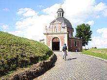
The province has several geographic or tourist regions: Important rivers are the Scheldt and the Leie which merge in Ghent.