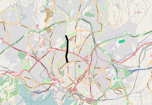
East End and West End of Oslo
The dialects have traditionally been quite different, and there has been a sharp distinction line between the sociolects of the two parts of the city, but this has somewhat diminished in the latest decades.
[citation needed] The economic difference is strengthened by the cultural capital of those who belong to the elite: social networks, education and activities that provide access to attractive jobs and other benefits.
[citation needed] The distinction between east and west also concerns life expectancy, use of disability pension and self-experienced health conditions.
Class distinctions play a smaller role for the majority of the population than in many other countries, and the good economic quality and living conditions of the Norwegian society are also reflected in the capital.
The outer east area includes the districts of Alna, Bjerke, Grorud and Stovner in Groruddalen, and Østensjø and Søndre Nordstrand further south.
[3] The mandatory use of masonry or timber hatch construction (murtvang) was enforced in the area from 1624, and in the early 18th century this use spread out about 200 metres outside the city walls.
The mandatory use of masonry, intended to prevent fire hazards, was found difficult to enforce already from 1624, and occasional disputes about it arose as the city grew.
[5] In the 1860s and especially in the 1870s, a ring of new, socially similar residence areas were built around the old town: Hegdehaugen, Uranienborg, along Drammensveien, Meyerløkka in the west, Fredensborg, Youngsløkka, the lower end of Grünerløkka and Nedre Tøyen in the east.
In the East End, the population became more homogenous than before: new immigrants from Eastern Norway and original citizens built the new worker class in the city of Kristiania together, affecting the growing industry, handwork, transport, and other areas.
In this early stage, new apartments for wealthy people in areas such as Gamlebyen (Schweigaards gate)[7] were built, and it was attractive to settle down in Kvadraturen.
[8] The areas to the north of the city centre belong to the West End, but they became very early, and still are, reflected by the middle class, having many officials, high education, and few rich people.
These areas include Meyerløkka, Gamle Aker, St. Hanshaugen, parts of Ila, Bolteløkka, Valleløkken, Fagerborg, Lindern and Adamstuen.
That this causes cleaner air in the western parts of the cities, because industry smoke blows towards the east, is sometimes cited as an explanation for the east-west division.
But the east-west distinction still showed through; in Torshov, Nordre Åsen, Vøyenvolden, Rosenhoff, Markus Thranes gate 8-20 and Tøyengata 47, the working class lived in the apartments.
Officials and other middle class moved into the apartments that were built in the West End: Ullevål hageby, Lindern, Jessenløkken.
Ilaløkken, which is located near the boundary line along Uelands gate, received a mixed population of middle class and workers.
The rise in living standards, better education and moving from factory to service jobs caused a less sharp class distinction between the east and the west than before the second World War.
This feeling of poverty and a step backwards was founded by real conditions, and intensified the differences between the inner east and the well-off West End.
The overall effect was that the overpopulated housing almost disappeared during the 20th century, and the quality of apartments and living conditions drastically improved for most of the city.
In the late 20th century, Oslo continued to have a much larger part of the population in the highest and the lowest income categories than other large cities in Norway, and the geographic boundary lines were stronger: Whereas 11% to 14% of the population of Bergen, Trondheim and Stavanger lived in typical high or low status areas, the number in Oslo was 40% (1994).
[23] A tightly built city causes strong limitations: In 2001, 36% of the apartments in Frogner had more than three rooms and a kitchen, whereas the number in Sagene was 10%.
The biggest health problems in the 21st century are found among the elderly and among immigrants from non-western countries, according to a study requested by the municipality of Oslo, conducted in 2007.
The votes for the Conservative Party vary by district from 26.6% in St. Hanshaugen to 45.5% (Vestre Aker) in the west, in the east from 12.0% in Grorud to 19.0% in Østensjø.
[36] A-endings ("gata"), diphthongs ("aleine", "blei"), the thick l and stress on the first syllable ("bannan") are traditional signs of the East End language.
[39] In the East End, the Oslo Metro is colloquially called banen ("the rail"), which stems from official name T-bane (t for tunnel), coined in the 1960s.
At that time, typical West End names were Henrik, Carl, Haakon, Bendik, Jens, Peder, William, Magnus, Axel, Nora, Thea, Andrea, Anna, Cecilie, Hanna, Hedda, Julie, Oda, Vibeke and Vilde.
Typical East End names were Daniel, Glenn, Tommy, Christer, Frank, Johnny, Anita, Jeannette, Mona, Nadia and Monica.
A group of names has been neutral in regard to the east-west division: Bente, Elin, Grete, Gunn, Merete, Siv, Espen, Geir, Kristian, Markus, Simon, Sindre, Thomas, Johan, Jens.
No area of Oslo has the signs that are commonly used to describe a ghetto (marked dilapidation, high criminality, significant poverty, and social misery).
In the district of Grønland and in the Hausmann area the street view is dominated by businesses owned by immigrants from other parts of the world.