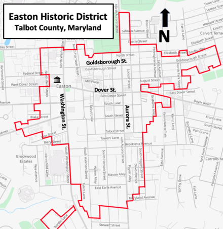
Easton Historic District (Easton, Maryland)
Although the town is part of the east coast of the United States, the region's history goes back to a time when Maryland was a colonial province of England.
Many of these buildings are residential, but the original business district, located on the west side, is also included.
Talbot County, as part of the Province of Maryland, began being settled during the mid-1600s with land grants from Lord Baltimore (Cecilius Calvert).
[3] Politics and society for the next two centuries were strongly influenced by members of the Goldsborough, Hollyday, Kerr, Lloyd, and Tilghman families.
After the American Revolution, the village became more important as the state of Maryland chose to establish administrative offices for the Eastern Shore at Talbot Courthouse.
[11] Its nearest waterfront (Tred Avon River) was about one mile (1.6 km) away, and eventually became known as Easton Point.
[11][14] During the War of 1812, Fort Stoakes was constructed on a plantation overlooking the Tred Avon River for protection from an attack by the British, and the local bank moved currency to a more secure place in Pennsylvania.
In 1869, a railroad line from Delaware connected Easton with major population centers in the eastern United States.
[12] The town has grown from Banning's time, and annexations include land along the Tred Avon River.
[21] The Easton Historic District includes the core of the town that began with a courthouse in the 18th century.
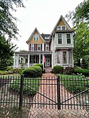
Most of the town's buildings in the historic section are brick structures from the late 19th and early 20th centuries.
At the extreme southwestern portion of the historic district is a non-contiguous section near Border Lane, and this is the location of the two Third Haven Meeting House buildings.