El Camino del Diablo
[3] In use for thousands of years, El Camino del Diablo began as a series of footpaths used by desert-dwelling Native Americans.
From there, the route continued to the northwest, following the western border of the Gila Mountains before finally reaching the Colorado River at Yuma Crossing.
El Camino del Diablo is believed to follow Native American footpaths dating to thousands of years ago.
In 1540, accompanied by native guides, Captain Melchor Díaz led a detachment of the Coronado Expedition through this vicinity en route to the Californias.
While prospectors and transient visitors continued to visit the area, El Camino del Diablo never regained its status as a major migration route.
With the exception of one United States Border Patrol station (Camp Grip),[10][11][12] the section of the original trail between Las Playas and Tinajas Altas remains virtually unchanged.
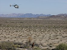
[13] Today, the Camino del Diablo remains a dirt road, suitable for four-wheel drive and high-clearance vehicles carrying extra water and emergency equipment.
From there, it continues west past San Cristobal Wash, following the northern edge of the Agua Dulce Mountains to reach Papago Well.
At Tinajas Altas, the road forks, and the traveler can take a shorter route which heads north through the Barry M. Goldwater Air Force Range, passing east of Raven Butte and Cipriano Pass and following the eastern border of the Gila Mountains, before finally reaching Interstate 8 and the Gila River at Wellton, Arizona.
To transit the entire trail, a permit is required from the Cabeza Prieta National Wildlife Refuge office in Ajo.