Eynesbury, Cambridgeshire
Eynesbury is an urban area in the civil parish of St Neots, in the Huntingdonshire district of Cambridgeshire, England.
Up until the time of the Norman Conquest, Eynesbury included the area north of Hen Brook which is now St Neots.
Eynesbury is an area of housing, and industrial and commercial buildings, now forming part of St Neots in Cambridgeshire.
It lies to the east of the River Great Ouse, to the south of Hen Brook, and to the north-west of the A428 road (St Neots by-pass).
Agricultural land lies to the east between the railway line and the A428 by-pass, but this is likely to be dedicated to housing in the coming years.
Iron age occupation has left evidence too, in the area occupied by Eynesbury School's games fields, and near Howitts Lane.
They were Belgic tribesmen from the Continent who conquered this part of the country in the century or so before the Roman invasion, and brought with them improved farming techniques.
A small Roman outpost was located a short distance to the west of that point, and a possible trading post has been identified in Eynesbury itself.
The settlement probably extended along the Great Ouse from the ford (near the site of the present-day road bridge) to the Coneygeare area.
[6][5] A settlement existed in Eynesbury in the middle of the 8th century AD, and possibly earlier, known by some variation of its present-day name.
About 975 AD a nobleman and landowner named Leofric (alternatively Earl Alric) and his wife Leofleda (alternatively Countess Ethelfleda) had acquired extensive lands in Eynesbury; the name still included the area north of the Hen Brook now called St Neots.
In 1085 William the Conqueror ordered that a survey of building and land ownership and value should be carried out, and this resulted in what is now known as the Domesday Book.
[12] The tax assessment in the Domesday Book was known as geld or danegeld and was a type of land-tax based on the hide or ploughland.
In 1876, the village of Eynesbury and part of the rural parish were included in the district controlled by the Local Board of St Neots.
It was only with the establishment of Longsands and Ernulf comprehensive schools in 1966 and 1971 that a full secondary education provision was made in St Neots.
St Neots Town Council Services are burials, grass cutting, play areas, public toilets, bins, committee meetings, events, and community centres.
[21] Town Councillors for Eynesbury are (at 2021) Diana Collins, Emma Speed, Justin Cooper-Marsh (also an HDC member, below) Douglas Terry and Caroline Green.
[22] Huntingdonshire District Council provides services such as building regulation enforcement, local planning, environmental health, leisure and tourism.
[23] Eynesbury is a part of the district ward of St Neots Eynesbury and is represented on the district council by three councillors, elected in May 2018 for four year terms: Barry Sidney Banks, Justin Christopher Cooper-Marsh and Douglas Terry, all of the Putting St Neots Residents First Party.
[27] Eynesbury was within the Huntingdon parliamentary constituency until the 2024 election, last represented in the House of Commons by Jonathan Djanogly (Conservative).
[28] Following the 2023 Periodic Review of Westminster constituencies, it was placed within St Neots and Mid Cambridgeshire, which returned Ian Sollom (Liberal Democrats) as MP at the 2024 United Kingdom general election.
Throughout the first half of the twentieth century this was regarded as too small to be viable, and after some abortive proposals, the new County of Huntingdon and Peterborough was established on 1 April 1965.
[30] The civil parish was Eynesbury Hardwicke, which included the rural area extending eastward nearly to Croxton.
In 2009 a further change was made, acknowledging the reality that St Neots was a single entity, having absorbed the urban part of Eynesbury as well as the Eatons.
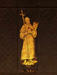
[note 2] It was described by Betjeman in 1958: Haphazard growth assimilating Norman and Pointed work (of three different periods), massive 'gothic survival' tower of 1688 south side, and chancel reshaped by Victorians.
[35] Gorham, writing in 1820, referred to this, and an update was provided by Ladds in 1926: Most of the site has been dug for gravel, but a considerable portion of the western side is now occupied as allotment gardens and here although it much eroded by the plough the lines of the vallum can still be distinctly seen.
At the western corner the outer angle of the bank is very clear and stands up some 5 feet above the surrounding ground but the inner line has been lost, doubtless by the cutting away of the vallum itself.
In those days his height was regarded as an extraordinary phenomenon, and he became famous; he was presented in London to the Emperor of Russia and the King of Prussia.
After touring the country in a show, he enlisted in the Life Guards, but his health was poor, and he left the army and returned home to Eynesbury.