Far Eastern Fells
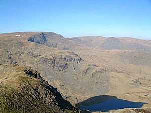
[1] Reaching their highest point at High Street (828 metres or 2.718 ft.), they occupy a broad area to the east of Ullswater and Kirkstone Pass.
Much quieter than the central areas of Lakeland[2] they offer in general easier walking as the fells merge mainly into the surrounding moorlands.
The most influential of all such authors was Alfred Wainwright, whose Pictorial Guide to the Lakeland Fells series has sold in excess of 2 million copies,[4] being in print continuously since the first volume was published in 1952.
[7] He determined instead upon straight lines connecting the outer limits of Ullswater and Haweswater, the proposed (and never built) Swindale Reservoir and Windermere.
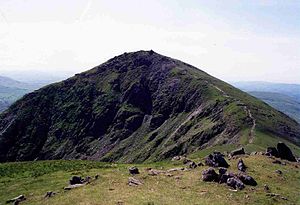
First, directly above the Inn at the summit of the pass, is Stony Cove Pike, known to devotees of Wainwright by its alternative name of Caudale Moor.
The western, Ullswater, side of the ridge is characterised by the steep U-shaped valleys of Martindale running north to the lake, rough grass, heather and bracken being the principal terrain.
Here the walker will find The Knott and Rest Dodd falling from the higher ground, beyond which are The Nab, Brock Crags and Beda Fell.
Before the lake was raised by a dam in the 1930s the small village of Mardale Green stood at the head of the valley, now only revealed during extended droughts.