Finland–Sweden border
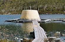
Almost the entire border runs through water: along the Tornio River and its tributaries, and in the Gulf of Bothnia.
[5] In the Norra Kvarken, the distance between land is down to 22.4 kilometres (12.1 nmi), giving less than the normal 12 nautical miles (22 km) to each country.
[6] The territorial waters meet again in the Sea of Åland, where the countries have a maritime border of 15 kilometres.
The border between the economic zones mainly runs in straight lines through defined coordinate points.
[9] The Finnish–Swedish border was created in 1809 by the Treaty of Fredrikshamn, as Sweden ceded Finland over to the Russian Empire.
[3] The borders were agreed to be the Sea of Åland, the Gulf of Bothnia, and the rivers Tornionjoki and Muonionjoki.
At the mouth of the Torniojoki river, the Pirkkiö island, the harbour of Röyttä and the city of Tornio were agreed to belong to Russia.
Kelottijerfvi, Paitiko, Nuimaka, Raunula et Kilpisjaure, jusqu'à la Norvège.
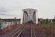
[16] Through the entire river border, near the eastern shore, the Finnish national road 21/European route E8 runs between Tornio and Kilpisjärvi.
[17] There are also two river bridges in Tornio (one carries the European route E4, also Finnish national road 29),[17] but they don't cross the border.
[2] In Haparanda/Tornio, there is a bus station common to both cities, which was opened in 2014 and is located on the Swedish side near the border (65°50′36″N 24°8′18″E / 65.84333°N 24.13833°E / 65.84333; 24.13833).