Fiordland
Fiordland (Māori: Te Rua-o-te-Moko, "The Pit of Tattooing",[1][2] and also translated as "the Shadowlands"), is a non-administrative geographical region of New Zealand in the south-western corner of the South Island, comprising the western third of Southland.
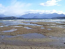
Due to the often steep terrain and high amount of rainfall supporting dense vegetation, the interior of the Fiordland region is largely inaccessible.
As a result, Fiordland was never subjected to notable logging operations, and even attempts at whaling, seal hunting, and mining were on a small scale and short-lived, partly also because of the challenging weather.
Of the twelve major fiords on Fiordland's west coast, Milford Sound / Piopiotahi is the most famous and the only one accessible by road.
Doubtful Sound / Patea, which is much larger, is also a tourist destination, but is less accessible as it requires both a boat trip over Lake Manapouri and bus transfer over Wilmot Pass.
Māori knew the area well but only visited seasonally, for hunting, fishing and to collect the precious stone pounamu (New Zealand jade) from Anita Bay at the mouth of Milford Sound / Piopiotahi.
Traditional histories recall the captain of the waka, Tamatea, lost his tattooing ink in Taiari / Chalky Inlet.
After the Tākitimu was wrecked at Te Waewae Bay, the crew decided to walk overland to the north of the South Island.
While stopping at Te Anau, Tamatea decided to dig a pit where wood could be burnt to create soot for tattoo ink.
The expeditions' maps and descriptions of the area attracted whalers and seal hunters, but only in the mid-19th century did surveyors and prospectors begin exploring Fiordland's interior.
New Zealanders generally regard the towns of Te Anau and Manapouri as part of the Fiordland region, even though they lie outside of the boundary of the national park.
Fiordland contains New Zealand's oldest known plutonic (igneous) rocks[17] and is dominated by the southernmost extent of the Southern Alps, as the peaks reduce in height from north to south.
The area has been categorised as the Fiordland temperate forests ecoregion, having a variety of habitats and, due to its isolation, a high number of endemic plants.
[25] The area is home to threatened native bird species, such as the flightless takahē and kiwi, blue duck (whio), and yellowhead (mōhua).
[29] Most of the area falls under the protection of the Fiordland National Park, part of the Te Wahipounamu World Heritage Site.
[39] Most tourists visit Milford Sound / Piopiotahi, though walking in the more accessible eastern parts of the alps is a popular activity.
Nonetheless, the remoteness of the region limits even tourism, and after short visits to the major sites, most tourists return to other areas, such as Queenstown or Invercargill.