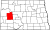
Fort Berthold Indian Reservation
The 2000 census reported a reservation population of 5,915 persons living on a land area of 1,318.895 sq mi (3,415.923 km²).
By executive order, the tribes' holdings were reduced to the light pink area (621) on July 13, 1880 (although they gained some extra land straight north of the Missouri).
On December 14, 1886, the tribes agreed to cede the land outside the nearly rectangular area on both sides of the Missouri indicated with black dots and strokes.
[9] In the late nineteenth and early twentieth centuries under the Dawes Act and related laws, the US government redistributed communal holdings of tribes, assigning lots to heads of households.
The creation of Garrison Dam between 1947–53 and Lake Sakakawea as water reservoir for irrigation, for flood control, and hydroelectric power generation in 1956, flooded of large areas of tribal lands that were devoted to farming and ranching, destroying much of the Three Affiliated Tribes’ economy.
[13][14] The reservation was well positioned when the application of hydraulic fracturing and directional drilling technologies caused a boom in oil production from the Bakken shale formation beginning around the year 2000.