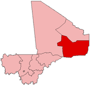
Gao
The city is located on the River Niger, 320 km (200 mi) east-southeast of Timbuktu on the left bank at the junction with the Tilemsi valley.
In 2012, Gao was captured from Malian government forces by National Movement for the Liberation of Azawad (MNLA) and Ansar Dine rebels.
After additional captures of Kidal and Timbuktu, the MNLA declared the region independent of Mali as the nation of Azawad[4] and named Gao its capital.
[5] The MNLA lost control to Islamist militias after the Battle of Gao in June 2012, with the city being recaptured by French military forces as part of Opération Serval in early 2013.
The town is located with road links (unpaved) to the desert Kidal Region to the north and to Niamey, the capital of Niger, to the south.
A service between Gao and Koulikoro, a distance of 1380 km (860 mi), is managed by the Compagnie Malienne de Navigation (COMANAV).
[1] For administrative purposes, the commune is divided into nine quartiers: Gadeye, Farandjiré, Aljanabanbia, Djoulabougou, Saneye, Sosso Koïra, Boulgoundjé, Château, and Djidara.
The rainfall in the headwater areas peaks in August but the flood water takes time to pass down the river system, through the Inner Niger Delta region and arrive at Gao.
The existing and proposed dams upstream of Gao reduce the overall flow of the river and could potentially have a large effect on the local agriculture.
Apart from some Arabic epitaphs on tombstones discovered in 1939 at the cemetery of Gao-Saney (6 km to the east of the city)[16] there are no surviving indigenous written records that date from before the middle of the 17th century.
[17] Our knowledge of the early history of the town relies on the writings of Arabic geographers living in Morocco, Egypt and Andalusia, most of whom never visited the region.
[20] Archaeological digs in Gao-Saney show that the site was occupied by roughly 700CE, and was a center of manufacturing, iron smelting, and trade with areas as far away as Mesopotamia.
He has a town on the Nile [Niger], on the eastern bank, which is called Sarnāh, where there are markets and trading houses and to which there is continuous traffic from all parts.
[35] al-Idrisi, writing in around 1154, does not mention a second town, and archaeological excavations in Gao-Saney indicate the site may have beena abandoned by this time.
In c.1079-1082, a Sanhaja Berber group, inspired by the Sunni Almoravids, took control of the area, leaving behind royal epitaphs at a cemetery in Gao-Saney.
[45] Lange, again going against more long-established opinions, argues that the Za were in fact Malian vassals and the Sonni were the ones who took refuge in Kukiya.
Ibn Khaldun recorded that in 776 A.H or 1374/1375 AD Mali fought a war over Gao against Berber Tuareg forces from Takedda, devastating the city.
[52]Towards the end of the 16th century, Gao controlled an empire that extended for over 1,400,000 km2, an area comparable in size to the modern state of Mali.
[53] The Tarikh al-fattash reports that a survey conducted during the reign of Askiya Al-Hajj (1582–1586) found that there were 7,626 houses without counting the huts made of straw.
[54] Assuming each house was occupied by an average of 6 people, this would imply a population of around 45,000, making Gao one of the largest cities in West Africa at the time.
In retaliation, the local youth are reported to have lynched Islamic police commissioner Aliou Toure who was recruited by MUWA, Movement for Oneness and Jihad in West Africa, who took control of the town in June 2012.
[62] In January 2013 French warplanes bombed parts of Gao, including the airport, in an attempt to drive out fighters from the Movement for Unity and Jihad in West Africa.
[65] Attractions in Gao include the original fourteenth century Kankou Moussa Mosque [fr], the Askia Tomb (a UNESCO World Heritage Site) built in 1495 and incorporating another mosque, a museum devoted to the Sahel, markets including a night market, and La Dune Rose, a sand dune named after its appearance at dawn and nightfall.
The mosques of the Niger Bend and the pre-Saharan steppe form a group corresponding to the northern extremity of the Sahel, in direct contact with the desert.
In short, this group of mosques is mainly found in northern Mali and Niger and is the prerogative of the Songhay and Tuareg populations.
It is characterised by a minaret, a low and projecting conical mihrab tower, the rarity of buttresses and battlements, and massive supports in the prayer hall, as in the mosques of Sankore and Sidi Yahya in Timbuktu and Tendirma in Mali.
Excavations in Gao Saney,[67]the oldest settlement east of the modern city, revealed a royal cemetery decorated with epitaphs and tombstones dating to 1104.
This mosque likely played a central role in the religious and cultural life of Old Gao, serving as a place of worship and community gathering.
In addition, the mosque tomb of Askia Muhammad, built between 1493 and 1538, displays unique architectural elements and extensive dimensions.
[71] Covering an area of some 2500 m2, this large structure consisted of seven bays parallel to the qibla wall, with arcades resting on wide piers.