Garmisch-Partenkirchen (district)
Garmisch-Partenkirchen (Bavarian: Garmasch-Partakurch) is a Landkreis (district) in Bavaria, Germany.
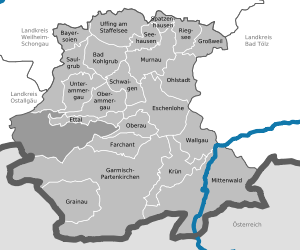
It is bounded by (from the west and clockwise) the districts of Ostallgäu, Weilheim-Schongau and Bad Tölz-Wolfratshausen, and by the Austrian state of Tyrol.
In medieval times the alpine lands were owned by the bishops of Freising and the abbots of Ettal Abbey.
The district is located in the Bavarian Alps and includes the highest mountain of Germany, the Zugspitze (2,962 m).
The highest peaks are grouped along the Austrian border, where the mountain ridges of the Wettersteingebirge and the Karwendelgebirge rise.