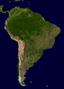
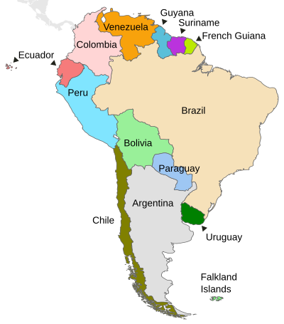
Geography of South America
With the exception of narrow coastal plains on the Pacific and Atlantic oceans, there are three main topographic features: the Andes, a central lowland, and the extensive Brazilian and Guiana Highlands in the east.
The very fertile soils from the erosion of the Andes formed the basis for the continent's only pre-Columbian state civilizations: those of the Inca Empire and its predecessors (Chavín, Nazca, Mochica, etc.).
[1] Most of this central lowland is sparsely populated because the soils are heavily leached, but in the south is the very fertile pampas of Argentina—one of the world's major food-producing regions where wheat and beef cattle are pre-eminent.
The eastern highlands are areas of Earth's crust that are much older than the Andes, being pre-Cambrian in origin, but are still rugged in places, especially in the wet tepuis of Venezuela, Guyana and Roraima.
The Amazon River has cut a large valley through a former highland, and to the east is a relatively low plateau comprising the Northeast and Southeast regions of Brazil.
As part of the Hadley model of atmospheric circulation, the equator is characterised by the ascending branches of separate meridional cells, driven by intense insolation.
Some studies advance ideas that describe one or more atmospheric cells over the equator,[28] while others state that the position of the ITCZ depends on Ekman pumping efficiency and moisture availability.
The South Atlantic High moves eastward, reflecting the pressure reduction over the continent and the intensity and direction of the zonal flow over the nearby tropics and sub-tropics.
As the SAMS progresses a continental-scale gyre transports moisture westward from the tropical Atlantic Ocean to the Amazon basin and then southward toward the extratropics of South America.
[32] The diabatic heating released in the SAMS region seems to promote that gyre, and the maintenance of the South Atlantic subtropical high during austral summer.
[39] It has also been suggested that is the subsidence over the cool SSTs of the eastern Pacific and extensive stratocumulus decks provide a radiative heat sink to the tropical atmosphere that can balance the adiabatic warming due to the monsoonal descent.
During April and May, the low-level southward flow of moisture from the western Amazonia weakens, as more frequent incursions of drier and cooler air from the mid-latitudes begin to occur over the interior of subtropical South America.