Geology of New Hampshire
The geology of New Hampshire is similar to that of the rest of New England in comprising a series of metamorphosed sedimentary and volcanic rocks of Late Proterozoic to Devonian age, intruded by many plutons and dikes ranging in age from Late Proterozoic to early Cretaceous.
The northernmost corner of the state lies in the Connecticut Valley trough of the Boundary Mountains composite terrane.
[2] The state is bounded by Quebec, Canada, to the north and northwest; Maine and the Atlantic Ocean to the east; Massachusetts to the south; and Vermont to the west.
The state border is not in the center of that river, as is usually the case, but at the low-water mark on the Vermont side; meaning that the entire river along the Vermont border (save for areas where the water level has been raised by a dam) lies within New Hampshire.
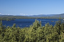
The Piscataqua River forms the state's only significant ocean port where it flows into the Atlantic at Portsmouth.
While New Hampshire, along with the rest of New England, does not frequently experience earthquakes, it has experienced several in history and has been affected by some of the larger events that were centered in the Saint Lawrence rift system in Canada.
Ten years later, another tremor was strongest in Concord, although Dover and Pittsfield reportedly had buildings shaken.
In 1929 the Grand Banks of Newfoundland (800 miles (1,300 km) to the east) experienced a magnitude 7.2 earthquake, and New Hampshire felt minor effects.
In 1935, a 6.25 earthquake centered in Timiskaming, Ontario, 500 miles (800 km) away, was felt in an area of over 2,500,000 square kilometers (970,000 sq mi), and some places in New Hampshire experienced Mercalli intensities as high as V (Moderate).