Geology of Russia
The geology of Russia, the world's largest country, which extends over much of northern Eurasia, consists of several stable cratons and sedimentary platforms bounded by orogenic (mountain) belts.
The craton is bounded on the east by the long tract of compressed and highly deformed rock that constitutes the Ural orogen.
In Asiatic Russia, the area between the Ural Mountains and the Yenisei River is the young West Siberian Plain.
The European part of Russia lies on the East European platform, a region up to 3,000 kilometres (1,900 mi) wide covered by more than 3 kilometres (1.9 mi) of metamorphosed sediments dating back to the Riphean stage (middle to late Proterozoic, from 1,400 to 800 million years ago).
These sediments lie on the East European craton, a remnant of Precambrian continental crust composed of magmatic and metamorphic rocks.
[1] The East European craton itself was created between 2.0 and 1.7 billion years ago when the microcontinents of Fennoscandia, Sarmatia and Volgo-Uralia collided.
[2] The Timan Ridge (Тиманский кряж – Timansky Kryazh) lies west of the Northern Ural mountains.
It is covered by 6 to 12 kilometres (3.7 to 7.5 mi) of sediments that were deposited during a series of marine regression and transgression events from the Proterozoic to the Cenozoic.
Dagestan to the Eastern end of the range is where the most thrusting to the North occurs and has formed a folded zone of sediments, overlying some of the Terek Basin.
[14] The Ural Mountains, a 2,500 kilometre (1,600 mi) long mountain chain that runs north–south at approximately 60° E longitude, formed in the Ural orogeny, a long series of mountain-building events occurring at the eastern margin of what is now the East European craton in association with its collision with another microcontinent (the Kazakhstania terrane) to the east.
[20] The West Siberian basin and its offshore portions in the south Kara sea are the largest oil province in the world.
[24] South of the fault are the Predivinsk terrane, made of island arc accretion, and the Angara-Kan micro-craton, which is sometimes considered separate from the fold belt.
[26][27] The Siberian craton formed in the Precambrian and is largely covered by sedimentary and volcanic rocks of more recent age.
Precambrian rocks are exposed in two distinct uplifts, the Anabar massif in the northeast and the Aldanian shield in the southeast.
[31] The Verkhoyansk-Kolyma orogen is composed of three parts: the Verkhoyansk fold-and-thrust belt, the Chersky collisional zone, and the Kolyma-Omolon microcontinent.
It consists of late Permian to Jurassic oceanic turbidites and volcanic deposits that are folded and were intruded by molten granite in the Cretaceous.
When the Kolyma-Omolon microcontinent collided with the Siberian craton the sedimentary stack of the Verhoyansk was folded and uplifted.
The orogen is composed of metamorphic basement rocks and cover made up of shallow water sediments, deposited between the Permian and the Triassic.
The Novosibirsk-Chukotka orogen is connected under the Chukchi Sea with the Brooks fold-and-thrust belt in Alaska.
The part of the Belt in Russia is believed to have formed when the Kokchetav and Altai-Mongolian terranes collided with the Siberia Craton.
[35] The Altai Structures reach into Russia, representing the extent of a mobile belt primarily lying south of the border.
[38] The driving forces of the rift are unknown; however, possibilities include the subduction of the Pacific Plate and the collision of the Indian subcontinent with Eurasia.
[39] Rifting resumed beginning in the Oligocene, and is commonly held to have increased since the middle Pliocene,[38] causing the formation of basins in the form of grabens.
[45] The Okhotsk-Chukotka Volcanic Belt was formed during the Cretaceous by the subduction of the Kula or Isanagai oceanic plate under the Verkhoyansk-Chukotka orogen.
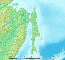
[46] The Kuril arc is a 2,300 kilometre (1,400 mi) long chain of volcanic islands stretching from the Kamchatka peninsula to Hokkaido (Japan).
[48] The West Kamchatka orogen is a regional geosynclinal complex of the Upper Cretaceous, which is superimposed on a granite-gneiss and schist-basic foundation, and which, after folding, was overlain by Paleogene–Neogene rocks.
[49] On the Central and Eastern Kamchatka-Olyutor systems of the Upper Cretaceous is built up a complex of paleogene volcanic-sedimentary strata.
[50] During the Late Pliocene – Early Pleistocene in the central zone there developed large basaltic shield volcanoes.
The Eastern Zone is characterized by current day volcanism (28 active volcanoes), coinciding with recent graben-like structures.