Georgetown, Guyana
It is the retail, administrative, and financial services centre of the country, and the city accounts for a large portion of Guyana's GDP.
The Secretariat of the international organization known as the Caribbean Community (CARICOM), with 15 member-states and five associate partners, is also based in Georgetown.
Georgetown is also known for its British and Dutch colonial influenced architecture, including the tall painted-timber St. George's Cathedral and the iconic Stabroek Market.
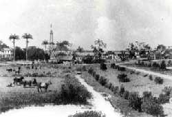
Originally, the capital of the Demerara-Essequibo colony was located on Borsselen Island in the Demerara River under the administration of the Dutch.
When the colony was captured by the British in 1781, Lieutenant-Colonel Robert Kingston chose the mouth of the Demerara River for the establishment of a town which was situated between Plantations Werk-en-Rust and Vlissingen.
[citation needed] By 1806, the owner of Vlissingen asked to be exempted from the responsibility of maintaining the road which is now called Camp Street, but the Court refused the request.
People elected to the board invariably declined to attend meetings and never gave reasons for their refusal.
[citation needed] Georgetown gained official city status on 24 August 1842 during the reign of Queen Victoria.
[3] The names of Georgetown's wards and streets reflect the influence of the Dutch, French, and British who administered the town at different periods of history.
It was laid out in streets and building lots by its second proprietor, Thomas Cuming, a Scotsman, from whom it gets its current name.
[citation needed] Water Street was so called because it ran along the riverside and formed the original river dam.
After his son and heir disappeared at sea, the government claimed the property under the authority of the Vlissengen Ordinance of 1876.
[4] Georgetown is located on Guyana's Atlantic coast on the east bank of Demerara River estuary.
The city is surrounded by a blanket of cane fields along with marshy swamps, and savannah lands on its east and south.
[citation needed] This low elevation is protected by a retaining wall known as the seawall to keep the ocean out and an innovative network of canals with kokers to drain the city of excess water.
[citation needed] Georgetown has a year-round hot trade-wind tropical rainforest climate (Af).
[9] Georgetown is laid out in a north–south, east–west grid, interlaced with canals protected by kokers (sluices), built by the Dutch and later the British that provide drainage to a city that lies 0.91 m (3 ft) below high-tide level.
Around the western-central area is Independence Square and Promenade Gardens, the Walter Roth Museum of Anthropology, the National Library (built by Andrew Carnegie), the Bank of Guyana, Company Path Garden, the National Museum of Guyana and State House (built 1852) where the president resides, St. George's Anglican Cathedral and the Red House.
More inland, surrounded by residential neighbourhoods are the Guyana Zoo, Botanical Gardens and Castellani House.
The Botanical Garden, in addition to a variety of plants, also features a manatee pond, as well as other enclosures housing felines such as jaguars, lynxes, or bobcats.
[11] The city's suburbs are also home to the Museum of African Heritage located in Bel Air Park.
North of Georgetown lies Main Street, where the head of state's official residence as well as the Ministry of Finance.
West of Stabroek Market is the Port of Georgetown, the largest and busiest shipping point in Guyana.
The south end incorporates communities of neighbourhoods along the eastern bank of the Demerara River such as Sophia, Roxanne Burnham Gardens, Albouystown, and Agricola.
Some areas such as Houston Estates, Ruimvelt and Thirst Park have retained high levels of affluence.