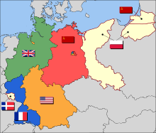
Former eastern territories of Germany
[1] Virtually the entire German population of the territories that did not flee voluntarily in the face of the Red Army advance of 1945, was violently expelled to Germany, with their possessions being forcibly expropriated.
This territory had large populations of Ukrainians, Belarusians and Lithuanians – the main ethnic groups of three of the western republics of the Soviet Union – and many towns that were primarily inhabited by Poles and Jews.
[8] Silesian cities such as Jelenia Góra (Hirschberg), Lwówek Śląski (Löwenberg) and Złotoryja (Goldberg) had typical architecture, being centered around a central square, the ring, which became known in Polish as rynek.
After losing the 18th-century Silesian Wars, the Habsburg monarchy was forced to cede most of the region to the Kingdom of Prussia in the treaties of Breslau and of Berlin, retaining only Austrian Silesia.
In the latter case, the Germans who arrived during the Middle Ages became mostly Polonised, especially with the advent of the industrial revolution which created employment and business opportunities, attracting numerous Poles to the area.
Under the Teutonic Order, the region's towns were founded, woodlands were cleared and marshlands made arable to be settled by colonists, predominantly from German-speaking areas but also from neighboring Polish and Lithuanian lands.
As a result of the Treaty of Versailles, a minor part around Soldau was transferred to Poland, the Klaipėda Region formed a free city supervised by the League of Nations, annexed following the Klaipėda Revolt by Lithuania but reclaimed by Germany in 1938, while the bulk (including entire Warmia and Masuria) remained a part of Germany, following the East Prussian plebiscite, and became enlarged by the addition of the formerly West Prussian Malbork Land.
Mieszko's son and successor, king Bolesław I Chrobry, upon the 1018 Peace of Bautzen expanded the southern part of the realm but lost control over the lands of Western Pomerania on the Baltic coast.
Władysław I the Elbow-high, who was crowned king of Poland in 1320, achieved a partial reunification, but the Silesian and Masovian duchies remained independent Piast holdings.
During the Napoleonic era the Greater Polish territories and the Chełmno Land formed part of the Duchy of Warsaw following the Treaties of Tilsit, and Danzig was granted a status of a Free City.
Its boundaries largely followed the ones of its predecessor, the Holy Roman Empire, defining the territory of Germany for much of the 19th century and confirming Pomerania, East Brandenburg and Silesia as its parts.
On the other hand, the remaining parts of the lands ruled by the House of Hohenzollern which were not included in the Holy Roman Empire, namely the German-speaking Prussian nucleus (East Prussia), and the newly acquired predominantly Polish- or Kashubian-speaking territorial share of the collapsed and dismembered Polish–Lithuanian Commonwealth (Grand Duchy of Posen and West Prussia), continued as external to the Confederation (a failed attempt to include these lands in the German Empire (1848–49) was undertaken by the Frankfurt Parliament), as did the Austrian-held partition of Poland (the Kingdom of Galicia and Lodomeria), Transleithania, as well as the German-speaking cantons of Switzerland and the French region of Alsace.
With rise of nationalism, the eastern Hohenzollern-ruled territories with a predominantly Polish population (especially the formerly Polish territories of Posen and West Prussia) increasingly became a target of aggressive Germanisation efforts, German settlement, anti-Catholic campaigns (Kulturkampf), as well as disfranchisement and expropriations of Poles, and finally annexed following the North German Confederation Treaty (1866).
The subsequent interwar economic crisis acted as a fertile ground for irredentist claims that the territory ceded to Poland, Czechoslovakia and Lithuania in 1919–1922 should be returned to Germany, which paved the way for the Nazi takeover of the government.
In the interwar period, the German administration, both Weimar and Nazi, conducted a massive campaign of renaming of thousands of placenames, to remove traces of Polish, Lithuanian and Old Prussian origin.
After Hitler's call for an international peace conference on Poland's borders in his 6 October 1939 Reichstag speech was rejected by both Édouard Daladier and Neville Chamberlain, another stripe of Polish lands was annexed.
After the German attack on the Soviet Union in June 1941, the district of Białystok, which included the Białystok, Bielsk Podlaski, Grajewo, Łomża, Sokółka, Volkovysk and Grodno counties, was "attached to" but not incorporated into East Prussia, and Eastern Galicia (District of Galicia), which included the cities of Lwów, Stanislawów and Tarnopol, was made part of the General Government.
The open questions were whether the border should follow the Eastern or Lusatian Neisse rivers and whether Stettin, the traditional seaport of Berlin, should remain in Germany or be included in Poland.
[30] Eventually, however, Stalin decided to keep Königsberg for strategic grounds (it would also be a year-round warm-water port for the Soviet Navy) and argued that the Poles should receive Stettin instead.
[31] After World War II, several memoranda of the US State Department warned against awarding Poland such extensive lands, apprehensive of creation of new long-standing tension in the area.
The Three Governments [of the Soviet Union, the United States and Great Britain], having considered the question in all its aspects, recognize that the transfer to Germany of German populations, or elements thereof, remaining in Poland, Czechoslovakia and Hungary, will have to be undertaken.
They agree that any transfers that take place should be effected in an orderly and humane manner.because in the words of Winston Churchill Expulsion is the method which, in so far as we have been able to see, will be the most satisfactory and lasting.
[36] The problem with the status of these territories was that the Potsdam Agreement was not a legally binding treaty, but a memorandum between the USSR, the US and the UK (to which neither France, nor Germany or Poland were party).
The majority of the remaining German-speaking population in the territory of former Czechoslovakia and east of the Oder–Neisse line (roughly 10 million in the Ostgebiete alone), that had not already been evacuated, was expelled by the new Czech and Polish administrations.
[43] However, contrary to the official declaration that the former German inhabitants of the Recovered Territories had to be removed quickly to house Poles displaced by the Soviet annexation, the new Polish lands initially faced a severe population shortage.
The process was finalized in 1950 by the Treaty of Zgorzelec, an agreement signed under Soviet pressure by Otto Grotewohl, prime minister of the provisional government of the GDR (East Germany) and Polish premier Józef Cyrankiewicz.
[citation needed] The Holy See immediately acknowledged the new reality following the Treaty of Warsaw, and created new Polish dioceses in the territories with the papal bulls Episcoporum Poloniae coetus and Vratislaviensis – Berolinensis et aliarium.
[citation needed] This happened on a smaller scale than many Poles expected, and the Baltic Sea coast of Poland has become a popular German tourist destination.
[citation needed] The so-called "homesickness-tourism" which was often perceived as quite aggressive well into the 1990s now tends to be viewed as a good-natured nostalgia tour rather than an expression of anger and desire for the return of the lost territories.
An expert report jointly commissioned by the German and Polish governments from specialists in international law have confirmed that the proposed complaints by the Prussian Trust had little hope of success.