Global Precipitation Measurement
It is part of NASA's Earth Systematic Missions program and works with a satellite constellation to provide full global coverage.
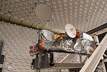
The project is managed by NASA's Goddard Space Flight Center, and consists of a GPM Core Observatory satellite assisted by a constellation of spacecraft from other agencies and missions.
[3] Agencies in the United States, Japan, India and France (together with Eumetsat) operate the remaining satellites in the constellation for agency-specific goals, but also cooperatively provide data for GPM.
[2] GPM has five broad science objectives:[4] The DPR is a spaceborne radar, providing three-dimensional maps of storm structure across its swath, including the intensity of rainfall and snowfall at the surface.
A Precipitation Education website[17] is also maintained to provide teachers and students with lesson plans, animations, and other resources to teach about the water cycle, Earth science, and the GPM mission.
[32] A short anime film of 6 minutes, Dual frequency Precipitation Radar Special Movie, was produced by JAXA and White Fox in 2013.