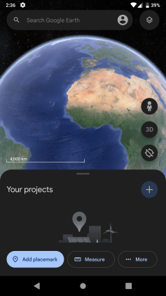
Google Earth
The program maps the Earth by superimposing satellite images, aerial photography, and GIS data onto a 3D globe, allowing users to see cities and landscapes from various angles.
Users may use the program to add their own data using Keyhole Markup Language and upload them through various sources, such as forums or blogs.
The web-based version of Google Earth also includes Voyager, a feature that periodically adds in-program tours, often presented by scientists and documentarians.
Google Earth has been viewed by some as a threat to privacy and national security, leading to the program being banned in multiple countries.
[10] The demo was popular, but the board of Intrinsic wanted to remain focused on gaming, so in 1999, they created Keyhole, Inc., headed by John Hanke.
[10] The product, called "Keyhole EarthViewer", was sold on CDs for use in fields such as real estate, urban planning, defense, and intelligence; users paid a yearly fee for the service.
[11] Despite making a number of capital deals with Nvidia and Sony,[11] the small company was struggling to pay and retain employees.
[10] Fortunes for the company changed in early 2003 during the 2003 invasion of Iraq, when Dave Lorenzini (Director at Keyhole) enticed CNN, ABC, CBS and other major news networks to use their sophisticated 3D flyby imagery to illustrate Baghdad Activities for viewers, in exchange for on-air attribution.
[11][10] During the invasion, It was used extensively by Miles O'Brien and other on-air broadcasters, allowing CNN and millions of viewers to follow the progress of the war in a way that had never been seen before.
[10] Intrinsic Graphics was sold in 2003 to Vicarious Visions after its gaming libraries did not sell well, and its core group of engineers and management including Brian McClendon and Michael Jones transitioned to Keyhole with Hanke remaining at the head.
This was achieved by combining multiple sets of imagery taken from Landsat 7 to eliminate clouds and diagonal gaps, creating a single "mosaic" image.
[23] By contrast, images created with NASA's globe software WorldWind use The Blue Marble, Landsat, or USGS imagery, each of which is in the public domain.
Using Street View on Google Earth, users can visit and explore 30 UNESCO World Heritage Sites with historical context and pins for each.
A unique activation that enabled viewers to search for hidden Pixar Easter eggs inside Toy Story Land at Disney's Hollywood Studios through street view.
This creative collaboration elevated Pixar's iconic tradition of hiding Easter eggs in films and introduced it to an immersive new platform.
[21] The high-resolution features were developed by oceanographers at Columbia University's Lamont–Doherty Earth Observatory from scientific data collected on research cruises.
New features such as multi-wavelength data, positions of major satellites and their orbits as well as educational resources are provided to the Google Earth community and also through Christian and Conti's website for Sky.
In addition to flat images, Google Earth also includes a layer for user-submitted panoramic photos, navigable in a similar way to Street View.
[54] Another flight simulator, GeoFS, was created under the name GEFS-Online using the Google Earth Plug-in API to operate within a web browser.
On September 30, 2010, Google made the configuration and schematics for their rigs public,[56] placing code and setup guides on the Liquid Galaxy wiki.
[62][63] The mobile versions of Google Earth can make use of multi-touch interfaces to move on the globe, zoom or rotate the view, and allow to select the current location.
[74] The Pro version includes add-on software for movie making, advanced printing, and precise measurements, and is available for Windows, macOS, and Linux.
A variety of third-party applications have been created which provide this functionality using the basic version of Google Earth by generating KML or KMZ files based on user-specified or user-recorded waypoints.
[83] This version added the "Voyager" feature, whereby users can view a portal page containing guided tours led by scientists and documentarians.
Beginning in 2007, donations are often accompanied by layers featured in Google Earth, allowing users to view a non-profit's projects and goals by navigating to certain related locations.
In June 2008, training was given to 20 indigenous tribes in the Amazon rainforest, such as the Suruí, to help them preserve their culture and raise awareness for the problem of deforestation.
[94][95] Google Earth Engine is a cloud computing platform for processing satellite imagery and other geospatial and observation data.
An early prototype of Earth Engine, based on the Carnegie Institute for Science's CLASlite system and Imazon's Sistema de Alerta de Desmatamento (SAD) was demonstrated in 2009[102] at COP15, and Earth Engine was officially launched in 2010[103] at COP16, along with maps of the water in the Congo Basin and forests in Mexico produced by researchers using the tool.
[104] Other early applications using Earth Engine spanned a diverse variety of topics, including: Tiger Habitat Monitoring,[105] Malaria Risk Mapping,[106] Global Surface Water,[107] increases in vegetation around Mount Everest,[108] and the annual Forest Landscape Integrity Index.
[143] One of the co-founders of Keyhole has published a first-hand account claiming to debunk the origins, timelines and interpretations depicted in the fictionalized miniseries.