Goreng Goreng
Walter Roth, while collecting data on their language in the later 19th century, placed them in Camboon Rawbelle where their main camp was at that time,[3] Jiggings.
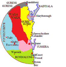
[4] Norman Tindale distinguished them from a Goeng Meerooni coastal people (1770/Agnes) and defined their land as extending over 2,300 square miles (6,000 km2) and embracing the eastern bank of the upper Burnett River from Mundubbera north to the Callide Ranges and east to Mt Perry Ranges and Many Peaks.
[1][7] A recent survey of the available evidence concludes that the Goreng Goring's lands encompassed the "whole of Boyne Valley to Auburn NoGo Callide Cania Ranges".
Hostilities broke out as land seized for grazing denied Aboriginal peoples access to their food resources, and clashes were frequent, leading to several massacres in the Miriam Vale area.
The severity of retaliation was sufficiently drastic to lead the Colonial Office to place the Burnett area's Aboriginal people under official protection by the Native Mounted Police.