Guadalajara, Spain
Lying on the central part of the Iberian Peninsula at roughly 685 meters (2,247 ft) metres above sea level, the city straddles the Henares River.
There is however no archeological proof of its existence, only references in texts such as the Ruta Antonina, which describe it as being in the hands of the Carpetani[3] when encountered by the Romans.
[8] The town was later known as Wādī Al-Ḥijāra (Arabic: وادي الحجارة), possibly meaning "Valley of Stones" (as in river gravel);[9] in theory it may be a literal translation of the Iberian name Arriaca.
[9] Wādī Al-Ḥijāra and its surroundings were part of the Middle March of Al-Andalus, controlled by the Masmuda Berber clan of the Banū Sālim who governed on behalf of the Umayyad rulers of Córdoba.
[13] The city was part of the territory annexed by Alfonso VI of León and Castile in the 1085 conquest of the Taifa of Toledo, with Wādī Al-Ḥijāra surrendering and offering no resistance.
[14] Tradition claims however that a contingent led by Álvar Fáñez de Minaya (one of the lieutenants of El Cid) seized the city on 24 June, at night.
[17] For most of its history, up until the 20th century, Guadalajara's water supply came from two sources: the Henares river and the springs located along the cornice formed by the border of the limestone moors of La Alcarria.
[18] Control over the scarce water resources was fought over and it became a symbol of social status for the local nobility during the Late Middle Ages.
[20] Despite the former meddling that underpinned the political control of the city, Guadalajara was not enshrined as formal seigneurial jurisdiction of the Mendozas in a legal sense.
He ordered the beheading of the local leaders of the insurgency and the deportation of his own son and successor Íñigo López de Mendoza, who had leaned towards the comunero cause.
[22] The city was affected by the 1610 expulsion of the moriscos both in terms of the net demographic loss (10% of the population) as well as by their critical weight in key sectors of the local economy such as the artisanate and trade.
[28] The 19th century started with two major setbacks: the damages caused by the Peninsular War (1808–1814) and the closing of the Real Fábrica de Paños in 1822.
[30] The desamortización entailed the change of use of religious buildings (turned to hospitals, high schools, military workshops),[31] the demolition of some convents to widen street space and to erect new residential areas,[32] and the reduction of the share of church properties in the estate structure.
[33] Both the declaration of Guadalajara as provincial capital and the parallel installment of the Academy of Military Engineers in the city in 1833, fostered some slow growth.
[37] The city was the target of several aerial bombing attacks by the Francoists;[38] the most famous, in December 1936, struck the Palacio del Infantado.
After four days of a slow, cautious advance during rainy weather, the tanks started attacking along paved roads and outran the air and anti-aircraft artillery support.
Shortly thereafter, Republican airplanes in newly clear skies found the tanks and infantry in a traffic jam on the main road into Guadalajara.
Second, some observing nations adopted a doctrine that ruled out tanks operating as an independent force but emphasized tying them tightly to large infantry formations.
[citation needed] Ciudad Valdeluz was planned to increase the number of inhabitants of Guadalajara by 30,000, creating a new city around the AVE Station (Spanish High-Speed Trains).
[citation needed] Chosen as settlement on the basis of defensive purposes, the historic urban core of the city lies on a small elevation near the left-bank of the Henares River, also enclosed to the East and West by two small ditches corresponding to two watercourses, Alamín [es] and San Antonio, respectively, forming a narrow and easily defendable space upon their confluence with the Henares.
The Church of los Remedios was declared Bien de Interés Cultural in 1924, and currently serves as the auditorium of the University of Alcalá.
[citation needed] The small villages (pedanías) of Iriépal, Taracena, Usanos, and Valdenoches that belong to the municipality feature few monumental landmarks other than their humble rural churches.
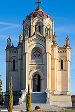
Of note also is Villaflores, a farming village built in 1887, designed by Ricardo Velázquez Bosco and commissioned to Maria Diega Desmaissières.