Guanahani
Upon his return to Spain in the spring of 1493, Columbus wrote a letter to Luis de Santangel, one of his patrons at the Royal Court of Castile.
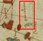
Juan de la Cosa was the owner and master of the Santa María and as such sailed with Columbus on the first voyage.
The Caribbean portion of the map shows Cuba and Hispaniola clearly, and a much more confused rendering of the Bahamas.
When Columbus returned to Spain after his first voyage, he reported to the royal court at Barcelona and presented his original log to the Spanish sovereigns.
The original soon disappeared, but the so-called 'Barcelona copy' was returned to Columbus prior to his second voyage and was in his possession at the time of his death in 1506.
At some point, Las Casas obtained the Barcelona copy and made the abstract now called the Diario.
The Barcelona copy disappeared late in the 16th century, but Las Casas' Diario was discovered intact in 1795 by Ferdinand de Navarette and published 30 years later.
In that sense, the primary utility of the biography is as a validity check on the Diario, a test which vindicates Las Casas in many respects.
Most importantly, the biography asserts that Guanahani was fifteen leagues (45 miles) long, which seems contrary to Columbus' implication in the Diario that he had seen the entire island on a single day's boat trip.
On reproductions of the map by Juan de la Cosa, who was with Columbus, Guanahani looks to some researchers like a string of small islands.
His vast overrun in distance was corrected by a fudge factor, leaving his endpoint in the vicinity of Watling's Island.
In 2004, Keith Pickering[9] applied magnetic declinations from a more modern source and found a track that ended in the vicinity of the Plana Cays.
A successful inter-island track must therefore navigate from Guanahani to the Ragged Islands in a way that fits the descriptions of the log without serious infidelity.
He arrived at Island II around noon, delayed by a contrary marea (usually translated as "tide", although "breeze" is possible), re-estimating the distance as seven leagues rather than five.
On the evening of 16 October, he arrived at a cape where the coastlines ran NNW and SSW[18] (though some scholars see a possible transcription error here).
Leaving the harbor after two hours, he then sailed northwest (rather than the previous NNW) "so far that I viewed all that part of the island as far as the coast that runs east-west".
Columbus ran into foul weather on the night of 17–18 October and gained sea room to avoid running onto a lee shore.
The following morning, 19 October, he split his fleet to search for the island of Samoete that his kidnapped native guides had told him about.
Leaving his Island III anchorage at dawn, Columbus sent Niña SSE and Santa María SE, while Pinta was sent "east and southeast" (contrary to the ESE mentioned in some sources).
He describes Island IV being "on an east-west course" from Island III (which contradicts his previous description of the fleet's movements in the search), and he also asserts that from the northern point the coast ran west for 12 leagues, to its western cape, Cabo Hermoso.
That attempt soon proved futile because it was too shallow, and Columbus reversed course and returned to the northern end, awaiting the arrival of the King which his kidnapped native guides had told him about.