Gulf Intracoastal Waterway
It is a navigable inland waterway running approximately 1,300 mi (2,100 km)[1] from Saint Marks, Florida, to Brownsville, Texas.
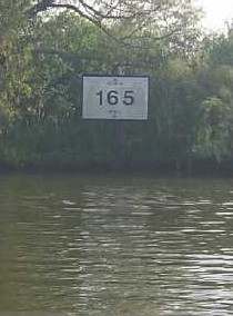
[4] Locations along the Gulf Intracoastal Waterway are defined in terms of statute miles (as opposed to nautical miles, in which most marine routes are measured) east and west of Harvey Lock, a navigation lock in the New Orleans area located at 29°54′32″N 90°05′02″W / 29.909°N 90.084°W / 29.909; -90.084.
The Hathaway Bridge in Panama City, Florida, for example, is at mile 284.6 EHL (East of Harvey Lock).
The Queen Isabella Causeway Bridge at South Padre Island is at mile 665.1 WHL (West of Harvey Lock).
They include: Many of the busiest ports in the United States in terms of tons of cargo[6] are located on or near the Gulf Intracoastal Waterway.