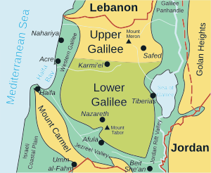
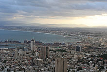
Haifa Bay
Fed by the Kishon River, the cities of Haifa and Acre mark its southern and northern capes, while its centre is lined with dunes and the suburban Krayot neighbourhoods.
Mount Carmel rises from the southern edge, while the mountains of the Western Galilee run up to the shore at the northern boundary.
According to paleogeographic studies, 3,000 to 3,500 years ago Haifa Bay was larger and extended as far as the area of present-day Kibbutz Yagur.
In the 1920s, several kibbutzim were established in the Bat Galim neighborhood on Haifa Bay in the wake of British Mandatory budgeting for development of the area.
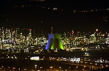
Historically the concentration of industry in the area has also led to pollution of the air and the bay, and a higher incidence of cancer in the surrounding communities.
[7] In response, since the late 2000s the Israeli Environment Protection ministry, in conjunction with area industries, has implemented a comprehensive pollution reduction, monitoring and reporting programme for the region.