Haleakalā
According to the legend, Māui's grandmother helped him capture the sun and force it to slow its journey across the sky in order to lengthen the day.
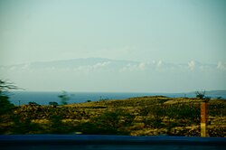
These two rift zones together form an arc that extends from La Perouse Bay on the southwest, through the Haleakalā Crater, and to Hāna to the east.
[citation needed] In its prime, Haleakalā may have reached a height of 12,000 feet before water and wind erosion, and possibly glaciers, began to carve two large river valleys out of the rim.
[citation needed] Eventually, these valleys formed gaps that merged at the volcano summit to create a crater-like basin.
Haleakalā, also known as East Maui Volcano,[5] was previously thought to have last erupted around 1790, based largely on comparisons of maps made during the voyages of La Perouse and George Vancouver.
[6][7] These last flows from the southwest rift zone of Haleakalā make up the large lava deposits of the Ahihi Kina`u/La Perouse Bay area of South Maui.
The park service has erected fences to prevent damage from local herbivores and from visitors taking the plants as souvenirs.
[14] Several species of native forest birds across Hawaiʻi are nearly extinct, including the kiwikiu and 'ākohekohe that are found only in East Maui, whose population decreased by more than 70% in the 21st century.
[15] The working group Birds, Not Mosquitos[16] joined with the National Park Service and the Hawaii Department of Land and Natural Resources to develop a plan to address the threat, eventually settling on the Incompatible insect model.
[17] As of 2024, each week some 250,000 male southern house mosquitos carrying Wolbachia bacteria were released on the mountain, totaling 10 million by June of that year.
The temperature near the summit tends to vary between about 40 and 60 °F (4 and 16 °C) and, especially given the thin air and the possibility of dehydration at that elevation, the walking trails can be more challenging than one might expect.
[21] Because of the remarkable clarity, dryness, and stillness of the air, and its elevation (with atmospheric pressure of 71 kilopascals (530 mmHg)[22]), as well as the absence of the lights of major cities, the summit of Haleakalā is one of the most sought-after locations in the world for ground-based telescopes (though to a lesser extent than Mauna Kea on neighboring Hawaii).
As a result of the geographic importance of this observational platform, experts come from all over the world to take part in research at "Science City", an astrophysical complex operated by the U.S. Department of Defense, University of Hawaii, Smithsonian Institution, Air Force, Federal Aviation Administration, and others.
Some of the telescopes operated by the US Department of Defense are involved in researching man-made (e.g. spacecraft, monitoring satellites, rockets, and laser technology) rather than celestial objects.
[25] The road is open to the public (although parts of it are restricted) and is a well-maintained two-lane highway containing many blind turns and very steep dropoffs.
There are a few tour guides on Maui that pick people up at their hotels, and outfit them with a bicycle to glide down the road from just outside the National Park boundary (starting at 6500 ft altitude).
The Haleakalā Ranger station, at a lower elevation, lies in the subtropical highland (Cfb, bordering on Csb if the 40 millimetres (1.6 in) threshold is used) climate zone.