Ham Hill, Somerset
The geology supports a wide range of fauna including mammals, birds, invertebrates, reptiles and amphibians living on lichens, fungi, ferns and flowering plants.
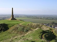
[1] The hill is part of a ridge of sandy limestone rock which is elevated above the lower lying clay vales and nearby Somerset Levels.
11.1 ha of the hill is designated as a geological Site of Special Scientific Interest (SSSI), notified in 1971, due to its particular importance to geologists because of the assemblages of fossils which it contains, the sedimentary features which it displays and the way it relates to other rocks of equivalent age in the close vicinity.
There is a major entrance to the south-east, on the line of the modern road and another to the north-east, following a track from the Church of St Mary the Virgin at East Stoke in Stoke-sub-Hamdon.
Archaeological finds include bronzework, chariot parts, iron currency bars, gold and silver coins, cremations and burials.
After the initial campaigns, a more permanent Roman camp was established at nearby Ilchester and the Fosse Way military road was constructed within 1 mile (2 km) of Ham Hill, on its way to Axminster and the garrison at Exeter.
The area was very prosperous in the Roman period and several major villas have been found nearby, including one on the eastern part of the hill in the field known as "Warren", with extensive mosaic.
South of the main hill are strip lynchets, or low terraces created by ancient ploughing and cultivation and the deserted medieval village of Witcombe (or Whitcombe), which was finally abandoned in the 17th century.
[25] The hill and the country park around it provide a venue for a variety of leisure and recreational uses, including walking, horse riding, mountain biking and orienteering.
[26] It is the end of the Leland trail, a 28 miles (45.1 km) footpath which runs from King Alfred's Tower to Ham Hill Country Park.
[29] Ham Hill is close to the Monarch's Way a 615-mile (990 km)[30] long-distance footpath which approximates the escape route taken by King Charles II in 1651, after being defeated at the Battle of Worcester.
[32] Ham Hill is operated as a 390 acres (160 ha)[33] country park by South Somerset District Council and is visited by over 250,000 people each year.
The absence of the sheep has also enabled woodland to overrun and obscure the previously grassed Iron Age earthworks, most noticeably on the northern flank of the hill.
A disastrous fire on the south-west flank of the hill (overlooking Little Norton) in the drought summer of 1976 was believed to have been caused by a discarded cigarette.
The deep ploughing proved counter productive as millions of poppy seeds were brought to the surface making the grain difficult to harvest - something that had been warned of years earlier by a previous farmer, but disregarded.