Geography of Hamilton, Ontario
Hamilton is located on the western end of the Niagara Peninsula and wraps around the westernmost part of the Lake Ontario.
This sandbar was deposited during a period of higher lake levels during the last ice age, and extends southeast through the central lower city to the escarpment.
John Ryckman, born in Barton township (where present day downtown Hamilton is), described the area in 1803 as he remembered it: "The city in 1803 was all forest.
"[6] George Hamilton, a settler and local politician, established a town site in the northern portion of Barton Township in 1815.
George Hamilton employed a grid street pattern used in most towns in Upper Canada and throughout the American frontier.
It took at least a decade for all of the original lots to be sold, but the construction of the Burlington Canal in 1823, and a new court-house in 1827 encouraged Hamilton to add more blocks around 1828–9.
At this time, he included a market square in an effort to draw commercial activity onto his lands, but the natural growth of the town was to the north of Hamilton's plot.
[13] This sandbar was deposited during a period of higher lake levels during the last ice age, and extends southeast through the central lower city to the escarpment.
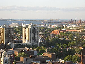
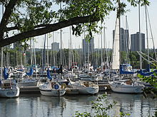
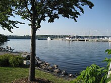
[14] Hamilton Harbour Fast Facts:[15] Downtown began and remains around Gore Park and the intersection of King and James Streets.
Some 'sections' of the city include: Ainslie Wood, The North End, Downtown, the East and West End, Westdale (the area where McMaster University is located, and therefore has a high percentage of students), Beasley, Crown Point, McQuesten, Stinson, Locke, Dundas, Ancaster (including Meadowlands, which is often seen as separate from Ancaster), the West, Central, and East Mountain, Stoney Creek and Stoney Creek Mountain.
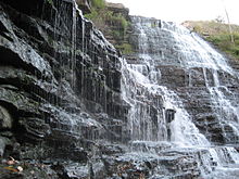
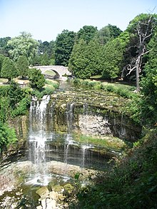
The Niagara Escarpment in Hamilton is a vertical wall of limestone, sandstone and shale that runs through southern Ontario from western New York to the Wisconsin/Illinois border.
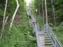
On average the Hamilton Mountain is 4–5 km inland from the Lake Ontario shoreline and at its edge affords views of the city and harbour.
Muds and sands were deposited from erosion of the Taconic Mountains to the south, creating the base shale and sandstone units of the Niagara Escarpment.
Later, during Silurian period, the Taconic Mountains stopped uplifting, erosion slowed, and calcium carbonate sediments formed, creating the upper limestone and dolomite beds of the Escarpment.
Fossils such as sponges, crinoids, brachiopods and rugose corals, indicating warm tropical waters, can be found in the Escarpment.
The lake laid down glaciolacustrine sediments such as sand and clay in the lower city and created the beach bar between Cootes Paradise and Hamilton Harbour.
These include, (in chronological order); Mountain Drive (1905), Beulah (1908), Stewart & LaSalle (1912), Delta (1914), Gage (1917), whose Rose Garden attracted tourists province-wide, Scott (1919), which eventually became the future home of Civic Stadium (Ivor Wynne Stadium), Parkdale & Chedoke (1925), Ainslie Woods (1927), King's Forest, Mahoney, and Donohue (1929), Bruce (1936), and Mount Hamilton (1939).
A decade later a bill was introduced in the Provincial Legislature calling for an even more ambitious project which when completed would become the "Mecca of flower lovers from all parts of North America" its supporters claimed.
The climate of the lower city is in general much more sheltered and milder than on top of the Mountain, which has a shorter growing season and in winter is prone to more wind whipped lake effect snows.