Hampshire County, West Virginia
Although its creation was authorized in 1754, Hampshire County was not actually organized until 1757[6] because the area was not considered safe due to the outbreak of the French and Indian War (1754–1763).
According to Samuel Kercheval's A History of the Valley of Virginia (1833), the county was named in honor of its several prize hogs.
Washington spent three summers and falls surveying Lord Fairfax's Northern Neck estate, which included all of the present-day Eastern Panhandle of West Virginia.
Oral traditions claimed that Washington laid present-day Romney out into lots at that time, but written records from that era indicate that Romney was surveyed and laid out into lots by James Genn prior to Washington's arrival.
At that time, he renamed the town Romney, in honor of the Cinque Ports city on the English Channel in Kent.
Confusion ensued for several decades concerning land ownership within the town, as counterclaims were made by the original settlers, and those who purchased lots laid out by Lord Fairfax's surveyors.
The vast majority of the remaining settlers, however, were in the vicinity of present Old Fields-Moorefield-Petersburg and were protected by the several forts in the area, including Fort Pleasant Once the Native Americans were defeated at the Battle of Point Pleasant in 1774 settlers, once again, returned to the county.
Additionally, with the end of the American Revolution, the Virginia Legislature nullified the English grant to Lord Fairfax in the region.
During the Whiskey Rebellion in 1794, many Hampshire County men volunteered to serve under Major General Daniel Morgan to put down the insurrection.
In 1775, two Baptist missionaries among a group of settlers moved to the Cacapon and organized the first European church in the county.
In 1753, Hampshire County had been formed into a parish by the Protestant Episcopal Church, and from 1772 until his death in 1777, Rev.
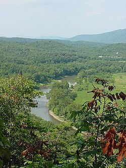
The wide lowlands of Hampshire County certainly invited agriculture, and fields of wheat and tobacco surrounded the important truck-patch of the settler.
The rolling uplands offered pasturage for horses, cattle, sheep, and hogs, which were driven across country to market at Winchester.
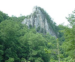
The streams abounded in fish and the mountains contained not only game but timber and stone for early settlers' homes.
The limestone was burned for lime at Bloomery Gap, where remains of old lime-kilns give evidence of an early industry.
The building of the Northwestern Turnpike (U.S. Route 50) was an integral part of the development of Hampshire County.
Colonel Claudius Crozet, a Frenchman who had previously worked for Napoleon Bonaparte, engineered the road which connected Parkersburg with Winchester, Virginia.
The turnpike traversed Hampshire County stretching through the communities of Capon Bridge, Loom, Hanging Rock, Pleasant Dale, Augusta, Frenchburg, Shanks, and Romney.
During the American Civil War, the Hampshire Guards and Frontier Riflemen joined the Confederate Army.
Although there were no major battles in Hampshire County, Romney changed hands at least fifty-six times during the war.
Some local Hampshire County historians speculate that Romney actually changed hands more than Winchester, but there are no surviving records to support the claim.
In 1863, West Virginia's counties were divided into civil townships, with the intention of encouraging local government.