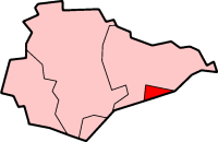
Hastings
Symeon of Durham records a battle fought at an unidentified location near Hastings in 771, at which Offa defeated the Haestingas tribe, effectively ending its existence as a separate kingdom.
[14] But, the Anglo-Saxon Chronicle for 1011 relates that Vikings overran "all Kent, Sussex, Surrey and Haestingas", indicating the town was still considered a separate 'county' or province to its neighbours 240 years after Offa's conquest.
[17] Muslim scholar Muhammad al-Idrisi, writing c.1153, described Hastings as "a town of large extent and many inhabitants, flourishing and handsome, having markets, workpeople and rich merchants".
[18] By the end of the Saxon period, the port of Hastings had moved eastward near the present town centre in the Priory Stream valley, whose entrance was protected by the White Rock headland (since demolished).
Hastings was then just a small fishing settlement, but it was soon discovered that the new taxes on luxury goods could be avoided by smuggling; the town was ideally located for that purpose.
[19] Near the castle ruins, on the West Hill, are "St Clement's Caves", partly natural but mainly excavated by hand by smugglers from the soft sandstone.
Their trade was to come to an end with the period following the Napoleonic Wars, for the town became one of the most fashionable resorts in Britain, brought about by the assumed health-giving properties of seawater, as well as the local springs and Roman baths.
[20] Like many coastal towns, the population of Hastings grew significantly as a result of the construction of railway links and the fashionable growth of seaside holidays during the Victorian era.
In 1897, the foundation stone was laid on a large concrete structure, but there was insufficient money to complete the work and the "Harbour Arm" remains uncompleted.
The German submarine U-118 was towed loose in a storm in the early morning of 15 April 1919 and ran aground on the beach at Hastings in Sussex at approximately 00:45, directly in front of the Queens Hotel.
In Victorian times and later the town has spread westwards and northwards, and now forms a single urban centre with the more suburban area of St Leonards-on-Sea to the west.
Roads from the Old Town valley lead towards the Victorian area of Clive Vale and the former village of Ore, from which "The Ridge", marking the effective boundary of Hastings, extends north-westwards towards Battle.
The town is generally built upon a series of low hills rising to 500 ft (150 m) above sea level at "The Ridge" before falling back in the river valley further to the north.
There are three Sites of Special Scientific Interest within the borough; Marline Valley Woods, Combe Haven and Hastings Cliffs To Pett Beach.
[23] Combe Haven is another site of biological interest, with alluvial meadows, and the largest reed bed in the county, providing habitat for breeding birds.
Hastings suffers at a disadvantage insofar as growth is concerned because of its restricted situation, lying as it does with the High Weald Area of Outstanding Natural Beauty to the north.
Rother has a policy of urban expansion in the area immediately north of Bexhill, but this requires infrastructure improvements by central Governments which have been under discussion for decades.
There are now various industrial estates that lie around the town, mostly on the outskirts, which include engineering, catering, motoring and construction; however, most of the jobs within the Borough are concentrated on health, public services, retail and education.
The Hastings Museum and Art gallery concentrates mostly on local history and contains exhibits on Grey Owl and John Logie Baird.
The nearby St. Clements Caves are home to the Smugglers Adventure, which features interactive displays relating to the history of smuggling on the south coast of England.
An important former landmark was "the Memorial", a clock tower commemorating Albert the Prince Consort which stood for many years at the traffic junction at the town centre, but was demolished following an arson attack in the 1970s.
Both are beset with traffic problems: although the London road, which has to contend with difficult terrain, has had several sections of widening over the past decades there are still many delays.
In 1753 many prominent Hastings figures – including the major landowners Edward Milward and John Collier – obtained an act of Parliament, the Hastings-Flimwell Turnpike Act, that allowed them to take control of the existing Hastings-London trackway via Battle and Whatlington, as far north as Flimwell,[61] however the first properly recognised turnpike developed in St. Leonards in 1837 when builder James Burton was building his new town of St Leonards.
The most important buildings from the late medieval period are the two churches in the Old Town, St Clement's (probably built after 1377) and All Saints (early 15th century).
[67] Christ Church, Blacklands (1876) has a complete decorative scheme of Mural, Stained Glass, Mosaic and Wrought Iron from the firm of Hardman's which gives it a ll* listing.
The 13.1 mi (21.1 km) race first took place in 1984 and attracts entrants from all over the country, taking runners on a route encircling the town, starting and finishing by the West Marina Gardens in St Leonards.
There are football clubs in Hastings that compete in the East Sussex League, such as Hollington United, St Leonards Social and Rock-a-Nore, playing at local parks and recreation grounds about the town.
United attracted sports media headlines, when in 2013 they made it to the third round of the FA Cup for the first time in their history, being the lowest ranked team left in the contest before going out – losing 4–1 to Middlesbrough.
[69] Hastings Priory is the town's largest cricket club, having 4 teams playing competitive, as well as a large junior section.
Hastings Conquerors is an American Football Club, founded in March 2013 by local resident Chris Chillingworth and currently trains at William Parker Sports College.