London Borough of Havering
It has a population of 259,552 inhabitants; the principal town is Romford, while other communities include Hornchurch, Upminster, Collier Row and Rainham.
Romford is a major retail and night time entertainment centre, and to the south the borough extends into the London Riverside redevelopment area of the Thames Gateway.
Modern settlement originated in Anglo-Saxon times when it consisted of Havering Palace and the surrounding lands that belonged to the king.
The origins of this name have been debated by historians since the Middle Ages when it was linked to the legend of Edward the Confessor and a mystical ring returned to him by Saint John the Apostle.
[2] London Underground and fast rail services to central London resulted in considerable residential land use mixed with designated parklands and farmland under the planning policy of the predecessor local authorities and current authority during the 20th century and into the early 21st century.
Also at this time new industries near the area such as the Ford Motor Company plant at Dagenham caused a new wave of mostly working class developments along the route of the new Underground line.
[4] It was converted into an urban district in 1894, was enlarged in 1934 to take in the neighbouring parishes of Havering-atte-Bower and Noak Hill, and was incorporated to become a municipal borough in 1937.
[7] Plans to extend existing developments in much of the borough are blocked as open land is protected as part of the Metropolitan Green Belt.
These places have developed over the last hundred years to form a large area of continuous urban sprawl with indistinct boundaries.
[8] Named neighbourhoods are the developments of Ardleigh Green, Chase Cross, Collier Row, Elm Park, Harold Hill, Rainham.
Havering has a significantly higher proportion of residents in white ethnic groups than other outer London boroughs (87.7% – 2011 census).
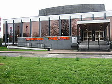
Romford has a developed night-time economy with one of the highest concentrations of bars and nightclubs anywhere in Greater London outside the West End with public transport radiating into all parts of the borough.
[25] The M25 motorway forms part of the borough boundary to the east with North Ockendon the only settlement to fall outside.
The A12 (near Romford) and the A13 (near Rainham) are the main trunk radial routes from central London and are located to the north and south of the borough respectively.
The A127 trunk route to Southend begins at Gallows Corner; which also forms the eastern end of the A118 local artery from Stratford.
In March 2011, the main forms of transport that residents used to travel to work were: driving a car or van, 31.8% of all residents aged 16–74; train, 11.9%; underground, metro, light rail, tram, 6.3%; bus, minibus or coach, 5.1%; on foot, 4.1%; work mainly at or from home, 2.4%; passenger in a car or van, 2.1%.
Time 107.5 FM is the commercial radio station broadcasting to Havering and surrounding areas and features local news.