Maritsa
With a length of 480 km (300 mi),[3] it is the longest river that runs solely in the interior of the Balkan peninsula, and one of the largest in Europe by discharge.
The Maritsa flows east-southeast between the Balkan and Rhodope Mountains, past Plovdiv and Dimitrovgrad in Bulgaria to Edirne in Turkey.
[7] The name Maritsa may derive from a mountain near the mouth of the river known in antiquity as Μηρισός or Μήριζος, Latinized as Merit(h)us.
This was further bolstered by Greece joining the European Union in 1981 (and then the Schengen area), marking the river as an external boundary of the EU.
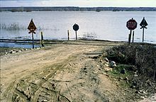
Since the 1990s, the river, as a natural barrier on the border between Turkey and Greece, has become a major route for migrants from a variety of countries attempting to enter the EU irregularly.
[10][11] In May 2020, news emerged that Turkish forces occupied 16 acres (6.5 ha) of Greek territory, Melissokomeio, as shown on maps of 1923, following a change in the flow of the river.
Several causes have been proposed, including more rainfall due to climate change, deforestation in the Bulgarian part of the catchment area, increased land use in the flood plains and difficult communication between the three countries.