Heilongjiang
Among Chinese provincial-level administrative divisions, Heilongjiang is the sixth-largest by total area, the 20th-most populous, and the second-poorest by GDP per capita after only Gansu province.
The province takes its name from the Amur river which marks the border between the People's Republic of China and Russia.
Ancient Chinese records and other sources state that Heilongjiang was inhabited by people such as the Sushen, Buyeo, the Mohe, and the Khitan.
The Jurchen Jin dynasty (1115–1234) that subsequently ruled much of north China arose within the borders of modern Heilongjiang.
Heilongjiang as an administrative entity was created in 1683, during the Kangxi era of the Manchu Qing dynasty, from the northwestern part of the Jilin province.
The eastern part of what's today Heilongjiang remained under the supervision of the General of Jilin (Girin i Jiyanggiyūn), whose power reached the Sea of Japan.
An additional advantage of Qiqihar may have been its location at the junction of a northbound road (to Nenjiang) and a westbound one (to Mongolia), enabling its garrison to defend both against the Russians and the Ölöt Mongols.
According to the 18th- and early-20th-century European sources and the reports of the Russians in the 1850s, the farthest Qing "advance guard" post was at Ulusu-Modon (Ulussu-Mudan) (Chinese: 乌鲁苏穆丹 Wūlǔsūmùdān), near the Amur river's famous S-shaped meander.
By the early twentieth century, due to the Chuang Guandong, the Han Chinese had become the dominant ethnic group in the region.
At the beginning of communist rule, Heilongjiang included only the western portion of the present-day province, and had its capital at Qiqihar.
During the Cultural Revolution, Heilongjiang was also expanded to include Hulunbuir League and some other areas previously in Inner Mongolia; this has since mostly been reversed.
[citation needed] The province's largest cities include Harbin, Qiqihar, Mudanjiang, Jiamusi, Daqing, Jixi, Shuangyashan, Hegang, Qitaihe, Yichun, and Heihe.
The Suifenhe - Manzhouli Expressway is another major corridor, it runs southeast to northwest and connects some of the most significant population centers of the province, including Mudanjiang, Harbin, Daqing and Qiqihar, before ending at the Heilongjiang - Inner Mongolia border.
The Harbin–Dalian high-speed railway, completed in 2012, stretches from Harbin, Heilongjiang's capital, to Dalian in Liaoning province via Changchun and Shenyang comprising 23 stops.
The Tongjiang-Nizhneleninskoye railway bridge was proposed in 2007 by Valery Solomonovich Gurevich, the vice-chairman of the Jewish Autonomous Oblast in Russia.
The railway bridge over the Amur river will connect Tongjiang with Nizhneleninskoye, a village in the Jewish Autonomous Oblast.
[31][32] The introduction of cold-resistant varieties, favorable policies and climate change have all contributed to a significant increase in rice production in recent years.
[citation needed] Heilongjiang is part of northeast China, the country's traditional industrial base.
[citation needed] As a result, the government has started the Revitalize Northeast China campaign to deal with this problem, promoting the private sectors as the preferred method of economic reform.
[3] The majority of Heilongjiang's population is Han Chinese, while ethnic minorities include the Manchus, Koreans, Mongols, Hui, Xibe, and Hezhen.
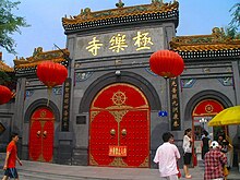
Harbin, the provincial capital, is a city of contrasts, with Chinese, Russian, and eclectic worldwide influences clearly apparent.
Lake Jingbo, in Ning'an County, is a section of the Mudan River that has been narrowed and shaped by volcanic eruption into a series of sights, including the Diaoshuilou Falls.
2 Formally part of Oroqen Banner in Inner Mongolia but administered de facto by Daxing'anling Prefecture in Heilongjiang.