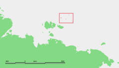
Henrietta Island
[2] Almost half of the island is covered by a central ice cap that reaches its maximum height at 312 m (1,024 ft) above sea level.
The ice cap area has a surface of approximately 6 km2 (2.3 sq mi) and occupies the highest south-eastern part of the island.
The southern and eastern edges of the ice cap are fringed by 40 to 50 m (131 to 164 ft) tall icy cliffs rising above the underlying basalt plateau.
In contrast, the strata are monoclinal with gently dipping beds in the south, east, and north of the island.
[1][3] American explorer and US Navy lieutenant commander George W. De Long set out in 1879 aboard the Jeannette, hoping to reach Wrangel Island and to discover open seas in the Arctic Ocean near the North Pole.
According to The Annual Report of the Secretary of the Navy, for the Year 1882 (p. 16), "A sled party landed, hoisted the national ensign, and took possession in the name of the United States".
A Soviet polar station was established on Henrietta Island in 1937 in an expedition by Rudolf Samoylovich, and closed in 1963.
Henrietta Island served in 1979 as the starting point for a Soviet expedition to the North Pole on skis.
[8] Some U.S. individuals assert American ownership of Henrietta Island, and others of the De Long group, based on the 1881 discovery and claim.