High Fichtel Mountains
As a natural region the High Fichtel Mountains are major unit 394 within the major unit group of the Thuringian-Franconian Highlands (39), that run from the Thuringian Forest to the Fichtel Mountains.
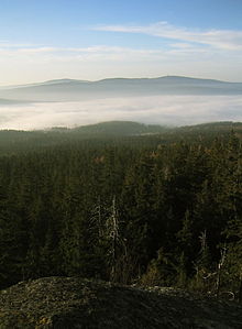
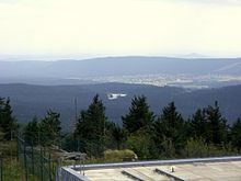
[5] The High Fichtel Mountains begin in the northeast at the Kornberg, continue via the Waldstein, Schneeberg, Ochsenkopf and Königsheide in the southwest to the Kösseine, then over the Steinwald and Reichsforst to the Kohlwald in the southeast.
In the geomorphological division of the neighbouring Czech Republic, the Aš Hills (German: Ascher Hügelland; Czech: Ašská vrchovina), the Hazlov Hills (Haslauer Hügelland or Hazlovská pahorkatina) and the Cheb Hills (Egerer Hügelland or Chebská pahorkatina) are counted as part of the (High) Fichtel range.
The history of its orogeny begins in the Pre-Cambrian about 750–800 million years ago – covering almost 20% of the earth's history, something which only applies to a few of the surviving ranges of the truncated Central Uplands of Germany today.
The mountains of the High Fichtel include the following, sorted by their elevation in metres (m) above sea level (NN):