Highways in Australia
Highways in Australia are generally high capacity roads managed by state and territory government agencies, though Australia's federal government contributes funding for important links between capital cities and major regional centres.
Prior to European settlement, the earliest needs for trade and travel were met by narrow bush tracks, used by tribes of Indigenous Australians.
The depression of the 1930s slowed the funding and development of the major road network until the onset on World War II.
Supply roads leading to the north of the country were considered vital, resulting in the construction of Barkly, Stuart, and Eyre Highways.
The decades following the war saw substantial improvements to the network, with freeways established in cities, many major highways sealed, development of roads in northern Queensland and Western Australia under the Beef Cattle Roads Grants Acts, and interstate routes between Sydney and Melbourne upgraded.
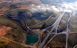
Some sections of the 16,000-kilometre-long (9,900 mi) National Highway system were no more than dirt tracks, while others were four lane dual carriageways.
In the following decades, the National Highway system was amended through legislation, and was eventually superseded in 2005 by the broader National Land Transport Network, which included connections to major commercial centres, and intermodal freight transport facilities.
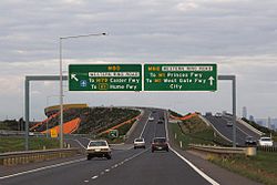
[2] Alphanumeric routes have been introduced in most states and territories in Australia, partially or completely replacing the previous systems.
[3] The earliest needs for trade and travel were met by narrow bush tracks, used by tribes of Indigenous Australian prior to European settlement.
[5] Road construction programs in the early 19th century were generally underfunded, as they were dependent on government budgets, loans, tolls and public subscription.
This problem was exacerbated by the huge increase in road usage, due to the Australian gold rushes.
The funds were specifically aimed at maintenance of roads outside of metropolitan cities, and state expenditure needed federal government approval; however, the primary purpose of the act was to reduce unemployment.
[5] The depression of the 1930s slowed the funding and development of the major road network until the onset on World War II.
[4][5] The decades following the war saw substantial improvements to the network, with freeways established in cities, many major highways sealed, development of roads in northern Queensland and Western Australia under the Beef Cattle Roads Grants Acts.
Large mining developments in the Pilbara region of Western Australia were undertaken lead to the improvement of the North West Coastal Highway from Carnarvon to Port Hedland, a project that involved building 30 bridges in a decade.
[4] In 1974, the federal government assumed responsibility for funding the nations most important road links.
The federal government fully funded construction and maintenance works undertaken by the states on these roads.
[4] The 16,000 kilometres (9,900 mi) of roads included in the original National Highway system varied greatly in quality.
[6]: 21–23 In 1988, the National Highway became redefined under the Australian Land Transport Development (ALTD) Act of 1988,[7] which had various amendments up to 2003.
The 1988 Act also defined a category of "Road of National Importance", which were partly funded by federal government.
The criteria for inclusion in the network was similar to the previous legislation, but expanded to include connections to major commercial centres, and inter-modal freight transport facilities.
[8] All of the roads included in National Land Transport Network as of 2005 were formally defined by regulation in October 2005.
[2] Alphanumeric routes have been introduced in most states and territories in Australia, partially or completely replacing the previous systems.
National Route 1 was assigned to a network of highways and roads, which together linked all capital cities and coastal towns circumnavigating the mainland.
The new system aimed to upgrade the signing of destinations, including previously unmarked roads, and to simplify navigation by allowing visitors to follow numbered routes.
While there are no immediate plans to introduce an alphanumeric route numbering system in Western Australia, it will begin converting once additional funds become available in the future.