History of Alexandria, Virginia
After Virginia seceded in 1861, Alexandria was swiftly captured by Union forces and held for the remainder of the American Civil War.
[2] However, the ground being unsuitable at that location, the warehouse was established a half-mile up river, where the water ran deep near the shore.
His estate, which consisted of 500 acres (2.0 km2), was bounded by Hunting Creek, Hooff's Run, the Potomac River, and approximately the line which would become Cameron Street.
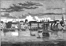
To support the Company's push for a town on the river, Lawrence's younger brother George Washington, an aspiring surveyor, made a sketch of the shoreline touting the advantages of the tobacco warehouse site.
It has been said that in order to avoid a predicament the petitioners offered to name the new town Alexandria, in honor of Philip's family.
As a result, Philip and his cousin Captain John Alexander (1711–1763) gave land to assist in the development of Alexandria, and are thus listed as the founders.
"[5] A "Public Vendue" (auction) was advertised for July, and the county surveyor laid out street lanes and town lots.
The name Belhaven was used in official lotteries to raise money for a Church and Market House, but it was never approved by the legislature and fell out of favor in the mid-1750s.
In April 1755, the governors of Virginia, and the Provinces of Maryland, Pennsylvania, Massachusetts, and New York met to determine upon concerted action against the French in America.
In March 1785, commissioners from Virginia and Maryland met in Alexandria to discuss the commercial relations of the two states, finishing their business at Mount Vernon.
The Maryland legislature, in ratifying this agreement on November 22, proposed a conference among representatives from all the states to consider the adoption of definite commercial regulations.
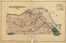
A portion of the City of Alexandria—known as "Old Town"--- and all of today's Arlington County share the distinction of having been originally in Virginia, ceded to the U.S. Government to form the District of Columbia, and later retroceded to Virginia by the federal government in 1846, when the District was reduced in size to exclude the portion south of the Potomac River.
In order to avoid the town's destruction, twenty-two merchant ships and large quantities of flour, tobacco, cotton, wine, and sugar were handed over by Alexandria's municipal authorities to the British.
As competition grew with the port of Georgetown and the Chesapeake and Ohio Canal fostered development on the north side of the Potomac River, the city's economy stagnated.
Alexandria was also an important port and market in the slave trade, and there were increasing talk of the abolition of slavery in the national capital.
Dr. K. J. Stewart, was arrested in the sanctuary on February 9, 1862, by Union troops who had attended with the stated purpose of provoking an incident.
Dr. Stewart proceeded without paying any attention to the interruption; but a captain and six of his soldiers, who were present in the congregation with intent to provoke an incident, drew their swords and pistols, strode into the chancel, seized the clergyman while he was still kneeling, held pistols to his head, and forced him out of the church, and through the streets, just as he was, in his surplice and stole, and committed him to the guard-house of the 8th Illinois Cavalry.
[20] For African American escaped slaves, the military occupation of Alexandria created opportunity on an unprecedented scale.
Over the course of the war, Alexandria was transformed by the Union occupiers into a major supply depot and transport and hospital center, all under army control.
[21] Because the escaped slaves were still legally property until the abolition of slavery, they were labeled as contrabands to prevent their being returned to their masters.
Contrabands took positions with the army as construction workers, nurses and hospital stewards, longshoremen, painters, wood cutters, teamsters, laundresses, cooks, gravediggers, personal servants, and ultimately as soldiers and sailors.
This newly enfranchised constituency provided the support necessary to elect the first black Alexandrians to the City Council and the Virginia Legislature.
[22] The population of contrabands flooding into Alexandria during the Union occupation included many who were destitute, malnourished and in poor health.
[27] President Woodrow Wilson visited the Virginia Shipbuilding Corporation on May 30, 1918 to drive the first rivet into the keel of the SS Gunston Hall.
[29] In 1940, both the Robert Robinson Library, which is now the Alexandria Black History Museum, and the Vernon Theatre opened[30] Jim Morrison of The Doors as well as Cass Elliot and John Phillips of The Mamas & The Papas attended the George Washington High School in the 1950s.
In 1972 Clifford T. Cline purchased the 1890 Victorian house at 219 King Street and converted it into the Creole serving Two-Nineteen Restaurant.
[41] The 2011 Foo Fighters album Wasting Light featured the track "Arlandria" named for a section of the city where Grohl once lived.
In 2014, legislation was introduced in the city council to repeal the 1963 law that requires new north–south streets to carry the name of a Confederate military leader.