History of Phoenix, Arizona
The post World War Two years saw the city beginning to grow more rapidly, as many men who had trained in the military installations in the valley, returned, bringing their families.
[7] The population growth was further stimulated in the 1950s, in part because of the availability of air conditioning, which made the very hot dry summer heat tolerable, as well as an influx of industry, led by high tech companies.
[8] However, on June 1, 2023, the State of Arizona announced the historic decision to halt new housing development in the Phoenix metropolitan area that relies solely on groundwater, due to a predicted water shortfall to support continued unregulated growth, in conjunction with climate change.
[citation needed] Inhabiting the southwestern United States and northern Mexico for tens of thousands of years, when the prey they depended on left the area, they followed in approximately 9,000 BC.
[13] Consisting of small bands of hunters and gatherers, these nomads traveled throughout the area for millennia, until about 3,000 years ago when their culture began to become an agricultural lifestyle.
This archaic Indian culture would give rise to the Hohokam peoples, who, right around the beginning of the Common Era, moved further north and settled in the Salt River basin.
[18] It is believed that a Hohokam witness of the supernova that occurred in 1006 CE created a representation of the event in the form of a petroglyph that can be found in the White Tank Mountain Regional Park west of Phoenix.
[24] The Akimel O'odham were the major Indian group in the area, and lived in small villages, with well-defined irrigation systems, which spread over the entire Gila River Valley, from Florence in the east to the Estrellas in the west.
[29][30][31][22] The Salt River's irregular supply of water and lack of navigability appears to have otherwise prevented stable communities from being established nearby until the modern period of US control.
[35][36] The North claimed the Salt River Valley as part of the Arizona Territory, formed by Congress in 1863 with its capital at Fort Whipple, before it was moved the following year to Prescott.
[41] In order to create a supply of hay for their needs, the fort established a camp on the south side of the Salt River in 1866, which was the first non-native settlement in the valley.
The history of the city begins with Jack Swilling, a Confederate veteran who in November, 1867 on a visit to the Fort's camp was the first to appreciate the agricultural potential of the Salt River Valley.
Due to economic considerations benefitting the members of SRVTA, the more westerly townsite was selected, and a 320 acres (1.3 km2) plot of land was purchased in what is now the downtown business section.
Another important event which occurred in 1893 was the passage of a territorial law which allowed Phoenix to annex land surrounding the city, as long as it obtained the permission of the inhabitants of that area.
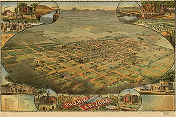
[15] By the turn of the century, the population of Phoenix had reached 5,554, and the following year, on February 25, 1901, Governor Murphy dedicated the permanent state Capitol building.
[54] The Phoenix weather was a major attraction for tuberculosis patients during a time when the only cure for the widespread, fatal lung disease was rest in a dry, warm climate.
[15] After the stock market crash of 1929, Sky Harbor was sold to another investor, and in 1930 American Airlines brought passenger and air mail service to Phoenix.
Its economy was still based on cotton, citrus and cattle, while it also provided retail, wholesale, banking, and governmental services for central Arizona, and was gaining a national reputation among winter tourists.
During World War II, Phoenix's economy shifted to that of a distribution center, rapidly turning into an embryonic industrial city with mass production of military supplies.
He entered Phoenix politics in 1949 when he was elected to the City Council as part of a nonpartisan team of candidates who promised to clean up widespread prostitution and gambling.
[83] In 1947 a new organization, the Phoenix Charter Revision Committee, began to analyze the administrative instability, factionalism, mediocrity and low morale that had long paralyzed city government.
While the committee could win all its elections, it was defeated on one major policy issue when a different grassroots group warned against urban renewal proposals, saying they were socialistic and threatened the rights of private property owners.
[15] The 1950s growth was spurred on by advances in mechanical air conditioning, which allowed both homes and businesses to offset the extreme heat known to Phoenix during its long summers.
The new industries were based on high technology, and attracted engineers and technicians who voted Republican and showed little interest in labor unions, as opposed to the heavily Democratic semiskilled workers in eastern factories.
[91] Architect Wenceslaus Sarmiento's largest project, the landmark Phoenix Financial Center (better known by locals as the "Punch-card Building" in recognition of its unique southeastern facade), was also finished in 1964.
The color lines were so rigid that no one north of Van Buren Street would rent to the African-American baseball star Willie Mays, in town for spring training in the 1960s.
[98] In 1968, the Central Arizona Project was approved by President Lyndon B. Johnson, assuring future water supplies for Phoenix, Tucson, and the agricultural corridor in between.
1972 would see the opening of the Phoenix Symphony Hall,[104] After the Salt River flooded in 1980 and damaged many bridges, the Arizona Department of Transportation and Amtrak worked together and temporarily operated a train service, referred to by the Valley Metro Rail as the "Hattie B."
[111] 1993 saw the creation of "Tent City," by Sheriff Joe Arpaio, using inmate labor, to alleviate overcrowding in the Maricopa County Jail system, the fourth-largest in the world.
[115] Crime rates in Phoenix have declined in recent years and once troubled, decaying neighborhoods such as South Mountain, Alhambra, and Maryvale, have recovered and stabilized.