Hogsmill River
[1] Nearby land was formerly flood-meadows; following improvements it is now mostly sports grounds, a sewage treatment works and green space, save for Kingston and Epsom town centres.
The source of the Hogsmill River is a chalk spring just outside Bourne Hall Park in Ewell, Surrey.
The Hogsmill passes the sites of the Lower and Upper Mills, and Ewell Court Mills, where gunpowder was produced in the 18th and 19th centuries, and gently bends to the left before flowing under the Mole Valley railway line between Ewell West and Stoneleigh at the start of the Hogsmill Open Space which follows the river until the borough boundary with Kingston.
It passes Riverview Primary School in the residential area of Ruxley Ward before the confluence with the Bonesgate Stream, which here marks the boundary between the boroughs of Epsom and Ewell in Surrey and Kingston in Greater London.
The river flows beside Worcester Park Road and Old Malden Lane (both the B284) along the edge of a few sports grounds and under the entrance to the Surbiton Raceway go-karting track.
The river leaves the boundary as it turns left into the outskirts of Old Malden in an area of woodland and green space.
The Hogsmill leaves the green space area at the railway line and passes Kingsmeadow, Kingston Cemetery and sewage works in the eastern outskirts of Kingston upon Thames, which covers not only that borough but also Epsom and Ewell which had a large sewage farm against the river in the decades around 1900.
The Hogsmill River meets the Thames beside a restaurant and street and promenade of shops beside the Thames Path footbridge at grid reference TQ177691, just upstream of Kingston Bridge.The Green Lanes Stream is 2.1 miles (3.4 km) long and starts as a run-off from Stamford Green Pond on the eastern edge of Epsom Common.
Ewell Court Stream is 1.7 miles (2.7 km) long[1] and starts near a pond on the edge of Nonsuch Park by the A24 (London Road) in Stoneleigh.
As it continues through the park towards the meeting point with the Hogsmill it passes the Packhorse Bridge, which was named after the mules that regularly transported gunpowder from the mills, across the river and into a brick magazine.
After crossing under Filby Road, it heads past the Bonesgate pub, now called the William Bourne, in Moor Lane on the eastern edge of Chessington.
The river then heads through open space, flowing under a bridge near Cox Lane Community Centre.
The river goes past the edge of the Cox Lane Estate shortly before joining the Hogsmill by Tolworth Court Bridge under the A240 Kingston Road.
From the William Bourne pub to Tolworth Court Bridge, the river serves as a boundary between West Ewell (Surrey) and Chessington (Greater London).
It is 3.3 miles (5.3 km) long and its source is near West Park Hospital beside Horton Lane, Epsom.
Its source is on the edge of Claygate from springs at Grapesome Wood on the west side of the A3,[5] It flows under the A3 to skirt Lovelace Primary School, north under Clayton Road between the withy bed and Oaklands Close, then through rugby playing fields and crosses the A309 Esher bypass going north between allotments and Kelvin Grove.
It is the central, northward, feature of Berrylands Nature Reserve; under Stirling Walk, it falls east under Elmbridge Avenue to meet the Hogsmill.
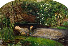
[9][10] The doorway (to the soul) in Hunt's The Light of the World is believed to be part of a gunpowder mill on the Hogsmill at Ewell.
Hogg's Mill found further use as a metal polish factory, possibly using crushed coconut shells as the secret ingredient.