Humber River (Ontario)
They join north of Toronto and then flow in a generally southeasterly direction into Lake Ontario at what was once the far western portions of the city.
The second wave, people of the Archaic period, settled the area between 7000 and 1000 BC and began to adopt seasonal migration patterns to take advantage of available plants, fish, and game.
The third wave of native settlement was the Woodland period, which saw the introduction of the bow and arrow and the growing of crops which allowed for larger, more permanent villages.
Brûlé passed through the watershed in 1615 on a mission from Samuel de Champlain to build alliances with native peoples, but left no written record.
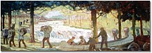
During late-17th and 18th century, the portage along this river was frequently used by the French traders as a short cut to the upper Great Lakes and the area north of Toronto.
Rousseau maintained several contacts in the area, although did not permanently relocate there until 1792; when he established a trading post near the mouth of the Humber River.
[14] Rousseau piloted John Graves Simcoe's ship into Toronto Bay to officially commence the settlement of York in 1793.
Settlement was scattered until after the War of 1812 when many loyalists moved to the area, who were joined by immigrants from Ireland and Scotland who chose to remain in British lands.
[3] More recently, a task force within the Authority was formed to further clear the Humber as a part of the Great Lakes 2000 Cleanup Fund.
The Humber watershed is a hydrological feature of south-central Ontario, Canada, principally in north and west Toronto.
It has an area of 903 square kilometres (349 sq mi), flowing through numerous physio-graphic regions, including the Oak Ridges Moraine and the Niagara Escarpment.
Since the flooding of Hurricane Hazel, it has been largely developed or redeveloped as parkland, with the extensive and important wetlands on its southern end remaining unmolested.
Today the majority of the Toronto portion of the Humber is parkland, with paved trails running from the lake shore all the way to the northern border of the city some 30 km away.